|
search place name
|
||
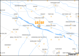
Gazar (Uzbekistan)Gazar is a town in Uzbekistan. An overview map of the region around Gazar is displayed below.
regional and 3d topo map of Gazar, Uzbekistan ::
Gazar airports ::
The nearest airport is SKD - Samarkand, located 37.3 km south east of Gazar.
Nearby towns ::
Khaladzhan (3.7km north) //
Krasnovostochnyy (5.6km south) //
Kara-Tukhum (4.3km east) //
Kara-Yantak (4.3km west) //
Ravat (5.7km north) //
Kuzan (4.7km north east) //
Kosh-Kuduk (6.4km south west) //
Shakhartepa (7.5km south) //
Kairma (7.5km south) //
Krasnyy Vostok (7.7km south) //
Tonyka (7.0km north east) //
Usmanovka (7.0km south east) //
Go‘zalkent (8.6km south) //
Shaykhlar (8.5km north) //
[all distances 'as the bird flies' and approximate] 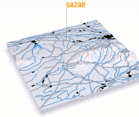 Places with similar names to Gazar, Uzbekistan ::
Disclaimer :: Information on this page comes without warranty of any kind |
||
|
Where is Gazar? Elevation and coordinates ::
Latitude (lat): 39°50'0"N Longitude (lon): 66°35'0"E
Elevation (approx.): 545m (map arrows pan, magnifying glasses zoom) |
||
|
Visiting Gazar? Hotel/Accommodation ::
Book a hotel in Gazar Travel Guide ::
Buy a travel guide for Uzbekistan rental cars ::
car rental offers GPS waypoint ::
download a GPX waypoint (PoI) of Gazar for your GPS receiver
|
||