|
search place name
|
||
(( Mayli-Tepe )) (Toshkent, Uzbekistan)(( Mayli-Tepe )) is a town in the Toshkent region of Uzbekistan. An overview map of the region around (( Mayli-Tepe )) is displayed below.
regional and 3d topo map of (( Mayli-Tepe )), Uzbekistan ::

(( Mayli-Tepe )) airports ::
The nearest airport is TAS - Tashkent Yuzhny, located 13.0 km north east of (( Mayli-Tepe )).
Other airports nearby include CIT - Chimkent Shymkent (135.3 km north), Nearby towns ::
Saidata (2.7km south west) //
Zangiata (4.3km north west) //
Ŭrtaowul (3.9km north west) //
Sergeli (4.8km north east) //
Surum (5.2km east) //
(( Nayma )) (7.5km south) //
Bagish (8.4km south) //
Solnechnyy (7.1km north west) //
(( Dzhunurun-Kala )) (7.9km south east) //
[all distances 'as the bird flies' and approximate] 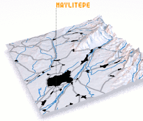 Places with similar names to (( Mayli-Tepe )), Uzbekistan ::
Disclaimer :: Information on this page comes without warranty of any kind |
||
|
Where is (( Mayli-Tepe ))? Elevation and coordinates ::
Latitude (lat): 41°10'0"N Longitude (lon): 69°11'0"E
Elevation (approx.): 375m (map arrows pan, magnifying glasses zoom) |
||
|
Visiting (( Mayli-Tepe ))? Hotel/Accommodation ::
Book a hotel in (( Mayli-Tepe )) Travel Guide ::
Buy a travel guide for Uzbekistan rental cars ::
car rental offers GPS waypoint ::
download a GPX waypoint (PoI) of (( Mayli-Tepe )) for your GPS receiver
|
||