|
search place name
|
||
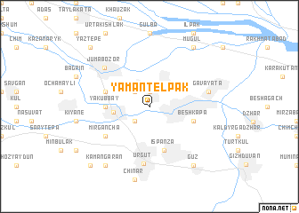
Yaman-Telʼpak (Uzbekistan)Yaman-Telʼpak is a town in Uzbekistan. An overview map of the region around Yaman-Telʼpak is displayed below.
regional and 3d topo map of Yaman-Telʼpak, Uzbekistan ::
Yaman-Telʼpak airports ::
The nearest airport is SKD - Samarkand, located 34.6 km north west of Yaman-Telʼpak.
Other airports nearby include DYU - Dushanbe (170.6 km south east), Nearby towns ::
Katta-Kayrakly (1.9km north) //
Kichine-Kaira (2.3km north west) //
Kayrakli (2.3km north west) //
Ala-Khatyn (2.3km south west) //
Tegana (2.3km south west) //
Yukary-Alʼgar (3.5km west) //
Yakub-Bay (4.3km west) //
Shtab (4.7km north west) //
Besh-Kapa (4.7km south east) //
Ispanza (5.7km south) //
Mirgancha (5.7km south west) //
Urgut (7.2km south) //
Jumabozor (6.5km north west) //
Gavay-Ata (6.0km east) //
Mugulʼ (8.6km north east) //
Guz (8.6km south east) //
Kamangaran (8.6km south west) //
Yaz-Tepe (9.4km north west) //
Besh-Bulak (9.4km south west) //
[all distances 'as the bird flies' and approximate] 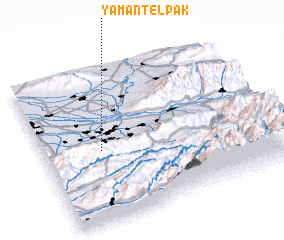 Places with similar names to Yaman-Telʼpak, Uzbekistan :: Disclaimer :: Information on this page comes without warranty of any kind |
||
|
Where is Yaman-Telʼpak? Elevation and coordinates ::
Latitude (lat): 39°28'0"N Longitude (lon): 67°15'0"E
Elevation (approx.): 829m (map arrows pan, magnifying glasses zoom) |
||
|
Visiting Yaman-Telʼpak? Hotel/Accommodation ::
Book a hotel in Yaman-Telʼpak Travel Guide ::
Buy a travel guide for Uzbekistan rental cars ::
car rental offers GPS waypoint ::
download a GPX waypoint (PoI) of Yaman-Telʼpak for your GPS receiver
|
||