|
search place name
|
||
Alor Bungga Sena (Kedah, Malaysia)Alor Bungga Sena is a town in the Kedah region of Malaysia. An overview map of the region around Alor Bungga Sena is displayed below.
regional and 3d topo map of Alor Bungga Sena, Malaysia ::

Alor Bungga Sena airports ::
The nearest airport is AOR - Alor Setar Sultan Abdul Halim, located 18.9 km north west of Alor Bungga Sena.
Other airports nearby include PEN - Penang Intl (84.1 km south), LGK - Pulau Langkawi Intl (88.0 km west), HDY - Songkhla Hat Yai Intl (99.8 km north), PAN - Pattani (112.7 km north east), Nearby towns ::
Kampong Alor Ali (0.0km north) //
Kampong Alor Pering (1.8km east) //
Kampong Tanjong Radin (1.9km south) //
Kampong Alor Mengkuang (1.9km north) //
Kampong Banggol Terus (1.9km north) //
Kampong Rambai (1.8km west) //
Kampong Jelai (1.8km west) //
Pekan Tanah Merah (2.6km south east) //
Kampong Tanjong Radin (2.6km south east) //
Kampong Alor Pudak (2.6km north east) //
Kampong Bukit Raya (2.6km south west) //
Kampong Alor Kemeling (2.6km north west) //
Kampong Tok Pauh (2.6km north west) //
Kampong Kuar (2.6km north west) //
Pendang (3.7km south) //
Kampong Kelopak Jantan (3.7km north) //
Kampong Banggol Tengah (3.7km north) //
Kampong Banggol Besi (4.1km south east) //
Kampong Seberang Pendang (4.1km south east) //
Kampong Sena (4.1km north east) //
Kampong Bukit Seni (4.1km south west) //
Kampong Limabelas Relong (4.1km south west) //
Kampong Alor Binjal (4.1km north west) //
Kampong Padang (4.1km north west) //
Kampong Bokbok (4.1km north west) //
Kampong Manjapahit (5.2km south east) //
Kampong Seberang Alor (5.2km south east) //
Kampong Balek Bukit (5.2km north east) //
Kampung Tobiar (5.2km north east) //
[all distances 'as the bird flies' and approximate] 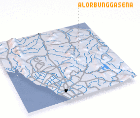 Places with similar names to Alor Bungga Sena, Malaysia :: Disclaimer :: Information on this page comes without warranty of any kind |
||
|
Where is Alor Bungga Sena? Elevation and coordinates ::
Latitude (lat): 6°2'0"N Longitude (lon): 100°28'0"E
Elevation (approx.): 3m (map arrows pan, magnifying glasses zoom) |
||
|
Visiting Alor Bungga Sena? Hotel/Accommodation ::
Book a hotel in Alor Bungga Sena Travel Guide ::
Buy a travel guide for Malaysia rental cars ::
car rental offers GPS waypoint ::
download a GPX waypoint (PoI) of Alor Bungga Sena for your GPS receiver
|
||