|
search place name
|
||
Alur Pongsu (Perak, Malaysia)Alur Pongsu is a town in the Perak region of Malaysia. An overview map of the region around Alur Pongsu is displayed below.
regional and 3d topo map of Alur Pongsu, Malaysia ::

Alur Pongsu airports ::
The nearest airport is PEN - Penang Intl, located 44.8 km north west of Alur Pongsu.
Other airports nearby include IPH - Ipoh Sultan Azlan Shah (76.4 km south east), AOR - Alor Setar Sultan Abdul Halim (129.5 km north), LGK - Pulau Langkawi Intl (171.8 km north west), PAN - Pattani (203.8 km north), Nearby towns ::
Kampong Sungai Semambu (1.8km west) //
Kampong Alor Semat (2.6km north east) //
Kampong Matang Jelutong (3.7km west) //
Kampong Jalan Kereta Api (3.7km east) //
Kampong Padang Lalang (4.1km south east) //
Kampong Panchor (5.5km east) //
Kampong Salengkok (5.6km south) //
Kampong Telok Medan (5.6km south) //
Kampong Bagan Samak (5.9km north) //
Bagan Serai (5.8km west) //
Kampung Beriah (5.9km north) //
Kampong Matang Pasir (5.9km north) //
Kampong Sungai Gedong (5.9km south) //
Kampong Raja (6.7km north west) //
Kampong Alor Kubu (6.7km south west) //
Kampong Telok Pulai (6.7km south west) //
Kampong Alor Senggut (6.7km south west) //
Bukit Merah (7.4km east) //
Kampong Sungai Bogak (7.6km west) //
Kampong Tebok Panchor (7.6km east) //
Kampong Bukit Merah (7.6km east) //
Kampong Tua (7.8km south east) //
Kampong Tebok Matau (7.8km south east) //
Kampong Kedah (8.3km south west) //
Kampong Kubu Gajah (9.2km south east) //
Kampong Gunong Semanggol (10.5km south east) //
Kampong Matang Pasir (10.5km south east) //
Kampong Sira Badak (10.5km north east) //
[all distances 'as the bird flies' and approximate] 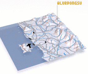 Places with similar names to Alur Pongsu, Malaysia :: Disclaimer :: Information on this page comes without warranty of any kind |
||
|
Where is Alur Pongsu? Elevation and coordinates ::
Latitude (lat): 5°2'0"N Longitude (lon): 100°35'0"E
Elevation (approx.): 4m (map arrows pan, magnifying glasses zoom) |
||
|
Visiting Alur Pongsu? Hotel/Accommodation ::
Book a hotel in Alur Pongsu Travel Guide ::
Buy a travel guide for Malaysia rental cars ::
car rental offers GPS waypoint ::
download a GPX waypoint (PoI) of Alur Pongsu for your GPS receiver
|
||