|
search place name
|
||
Batitian (Sabah, Malaysia)Batitian is a town in the Sabah region of Malaysia. An overview map of the region around Batitian is displayed below.
regional and 3d topo map of Batitian, Malaysia ::

Batitian airports ::
The nearest airport is BKI - Kota Kinabalu Intl, located 108.1 km south west of Batitian.
Other airports nearby include LBU - Labuan (221.3 km south west), LDU - Lahad Datu (230.2 km south east), BWN - Brunei Intl (273.7 km south west), LMN - Limbang (276.6 km south west), Nearby towns ::
Tingkalanun (1.9km north) //
Rasak (2.6km south west) //
Tandik (3.7km north) //
Longab (3.7km south) //
Salimandut (4.1km south east) //
Talantang (5.6km south) //
Rakit (5.8km west) //
Kampong Karungkon (7.4km west) //
Ongkilan (7.6km west) //
Tinago (7.6km east) //
Katud (8.2km south west) //
Timbang Batu (9.2km south west) //
Talas (9.2km south west) //
[all distances 'as the bird flies' and approximate] 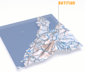 Places with similar names to Batitian, Malaysia ::
// Butsheni (ZA)
// Butchino (RU)
// Bād Āshīān (IR)
// Botshuni (CD)
// Bet Sheʼan (IL)
// Baydachnyy (RU)
// Badoushan (CN)
// Badoushan (CN)
// Beidatian (CN)
// Bédéchan (FR)
Disclaimer :: Information on this page comes without warranty of any kind |
||
|
Where is Batitian? Elevation and coordinates ::
Latitude (lat): 6°30'0"N Longitude (lon): 116°51'0"E
Elevation (approx.): 9m (map arrows pan, magnifying glasses zoom) |
||
|
Visiting Batitian? Hotel/Accommodation ::
Book a hotel in Batitian Travel Guide ::
Buy a travel guide for Malaysia rental cars ::
car rental offers GPS waypoint ::
download a GPX waypoint (PoI) of Batitian for your GPS receiver
|
||