|
search place name
|
||
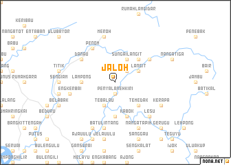
Jaloh (Malaysia)Jaloh is a town in Malaysia. An overview map of the region around Jaloh is displayed below.
regional and 3d topo map of Jaloh, Malaysia ::
Jaloh airports ::
The nearest airport is SBW - Sibu, located 87.1 km north east of Jaloh.
Other airports nearby include KCH - Kuching Intl (141.6 km west), SQC - Sintang Susilo (167.0 km south), BTU - Bintulu (232.4 km north east), Nearby towns ::
Penyalaneh Kiri (1.9km south) //
Penyalaneh Kanan (1.9km south) //
Bagumbang (2.6km north east) //
Sungai Langit (4.1km north east) //
Langit (4.1km north east) //
Sungai Tipus (4.1km north east) //
Tebalau (4.1km south west) //
Sungai Kepayang (5.2km north east) //
Temedak (5.2km south east) //
Lampong (5.6km west) //
Mupoh (5.6km south) //
Kabok (5.9km south) //
Nanga Linsum (6.7km north east) //
Danau (6.7km north west) //
Penom (6.7km north west) //
Meroh (7.6km north) //
Engkerbai (7.6km west) //
Udau (7.6km west) //
Batu Lintang (7.6km south) //
Lesu (7.9km south east) //
Luing (7.9km south east) //
Kerapa (8.3km south east) //
Nanga Tapih (8.3km south east) //
Temedak (8.3km south west) //
Lubau (8.3km south west) //
Gerugu (10.5km south east) //
[all distances 'as the bird flies' and approximate] 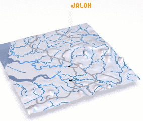 Places with similar names to Jaloh, Malaysia ::
Disclaimer :: Information on this page comes without warranty of any kind |
||
|
Where is Jaloh? Elevation and coordinates ::
Latitude (lat): 1°34'0"N Longitude (lon): 111°37'0"E
Elevation (approx.): 168m (map arrows pan, magnifying glasses zoom) |
||
|
Visiting Jaloh? Hotel/Accommodation ::
Book a hotel in Jaloh Travel Guide ::
Buy a travel guide for Malaysia rental cars ::
car rental offers GPS waypoint ::
download a GPX waypoint (PoI) of Jaloh for your GPS receiver
|
||