|
search place name
|
||
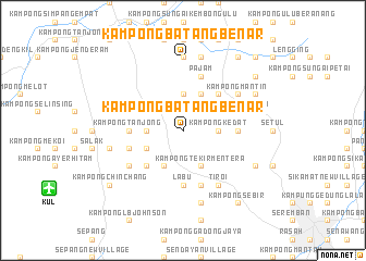
Kampong Batang Benar (Negeri Sembilan, Malaysia)Kampong Batang Benar is a town in the Negeri Sembilan region of Malaysia. An overview map of the region around Kampong Batang Benar is displayed below.
regional and 3d topo map of Kampong Batang Benar, Malaysia ::
Kampong Batang Benar airports ::
The nearest airport is KUL - Kuala Lumpur Intl, located 15.0 km south west of Kampong Batang Benar.
Other airports nearby include MKZ - Malacca (75.4 km south east), DUM - Dumai Pinang Kampai (139.0 km south), KUA - Kuantan (187.1 km north east), IPH - Ipoh Sultan Azlan Shah (212.1 km north west), Nearby towns ::
Kampong Bukit (1.9km north) //
Kampong Mahang (3.7km north) //
Kampong Momor (3.7km west) //
Kampong Kedat (3.7km east) //
Kampong Lambar (4.1km south west) //
Kampong Tekir Mentera (4.1km south east) //
Kampong Tekir (4.1km south east) //
Kampong Baharu Pajam (4.1km north east) //
Kampong Jerangkang (4.1km south west) //
Sepang Road (4.1km north west) //
Kampong Baharu Nilai (4.1km north west) //
Kampong Kondok (4.1km south west) //
Kampong Pulau Berangan (5.2km south west) //
Kampong Gebok (5.2km north east) //
Kampong Gidong (5.6km east) //
Kampong Ulu Mantin (5.6km east) //
Kampong Junjun (5.6km east) //
Kampong Labu (5.6km south) //
Labu (5.6km south) //
Kampong Tekir Jawa (5.6km south) //
Kampong Bukit Kadir (5.6km west) //
Kampong Tanjong (5.6km west) //
Kampong Kering Tengah (5.9km south) //
Kampong Kering (5.9km south) //
Pajam (5.9km north) //
Kampong Baharu Che Lah (5.9km east) //
Kampong Masjid (5.9km east) //
Kampong Labu Hilir (5.9km west) //
Kampong Mantin (6.7km north east) //
[all distances 'as the bird flies' and approximate] 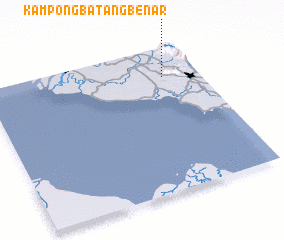 Places with similar names to Kampong Batang Benar, Malaysia ::
// Kampong Batang Benar (MY)
Disclaimer :: Information on this page comes without warranty of any kind |
||
|
Where is Kampong Batang Benar? Elevation and coordinates ::
Latitude (lat): 2°48'0"N Longitude (lon): 101°50'0"E
Elevation (approx.): 431m (map arrows pan, magnifying glasses zoom) |
||
|
Visiting Kampong Batang Benar? Hotel/Accommodation ::
Book a hotel in Kampong Batang Benar Travel Guide ::
Buy a travel guide for Malaysia rental cars ::
car rental offers GPS waypoint ::
download a GPX waypoint (PoI) of Kampong Batang Benar for your GPS receiver
|
||