|
search place name
|
||
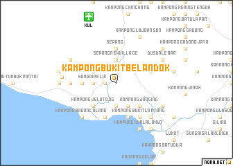
Kampong Bukit Belandok (Negeri Sembilan, Malaysia)Kampong Bukit Belandok is a town in the Negeri Sembilan region of Malaysia. An overview map of the region around Kampong Bukit Belandok is displayed below.
regional and 3d topo map of Kampong Bukit Belandok, Malaysia ::
Kampong Bukit Belandok airports ::
The nearest airport is KUL - Kuala Lumpur Intl, located 11.5 km north west of Kampong Bukit Belandok.
Other airports nearby include MKZ - Malacca (70.3 km south east), DUM - Dumai Pinang Kampai (120.4 km south), KUA - Kuantan (204.4 km north east), IPH - Ipoh Sultan Azlan Shah (224.3 km north), Nearby towns ::
Kampong Batu Empat (1.9km west) //
Kampong Batu Dua (1.9km west) //
Sungai Pelik (3.7km west) //
Sungai Nipah New Village (3.7km south) //
Sepang New Village (3.7km north) //
Sungai Linau New Village (4.1km north west) //
Kampong Sawah (4.1km south east) //
Kampong Jelutong (5.2km south west) //
Kampong Janging (5.2km south east) //
Sungai Pelek New Village (5.6km west) //
Sepang (5.6km north) //
Dusun Lumbong (5.9km east) //
Kampung Cuah (5.9km south) //
Kampong Sungai Nipah (5.9km south) //
Kampong Bukit Lantang (6.7km south east) //
Kampong Sungai Rawang (7.4km west) //
Tanah Merah New Village (7.9km south east) //
Kampong Batu Lapan Belas (7.9km south east) //
Kampong Bagan Lalang (7.9km south west) //
Kampung Kuala Lukut (8.3km south east) //
Kampong Telok (8.3km south east) //
Kampong L.B. Johnson (8.3km north east) //
Kampong Baru (8.3km south east) //
Kampong Ulu Chuchoh (8.3km north west) //
Dusun Durian Gerat (8.3km north east) //
Dusun Lebar (8.3km north east) //
Kampung Sirawang (8.8km west) //
Kampong Telok Meranti (9.3km south east) //
Dusun Bawang (9.3km north east) //
[all distances 'as the bird flies' and approximate]  Places with similar names to Kampong Bukit Belandok, Malaysia :: Disclaimer :: Information on this page comes without warranty of any kind |
||
|
Where is Kampong Bukit Belandok? Elevation and coordinates ::
Latitude (lat): 2°39'0"N Longitude (lon): 101°45'0"E
Elevation (approx.): 3m (map arrows pan, magnifying glasses zoom) |
||
|
Visiting Kampong Bukit Belandok? Hotel/Accommodation ::
Book a hotel in Kampong Bukit Belandok Travel Guide ::
Buy a travel guide for Malaysia rental cars ::
car rental offers GPS waypoint ::
download a GPX waypoint (PoI) of Kampong Bukit Belandok for your GPS receiver
|
||