|
search place name
|
||
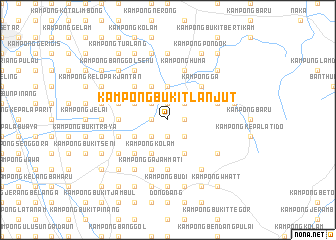
Kampong Bukit Lanjut (Kedah, Malaysia)Kampong Bukit Lanjut is a town in the Kedah region of Malaysia. An overview map of the region around Kampong Bukit Lanjut is displayed below.
regional and 3d topo map of Kampong Bukit Lanjut, Malaysia ::
Kampong Bukit Lanjut airports ::
The nearest airport is AOR - Alor Setar Sultan Abdul Halim, located 22.9 km north west of Kampong Bukit Lanjut.
Other airports nearby include PEN - Penang Intl (86.2 km south), LGK - Pulau Langkawi Intl (94.9 km west), HDY - Songkhla Hat Yai Intl (100.7 km north), PAN - Pattani (107.8 km north east), Nearby towns ::
Kampong Bukit Bubus (1.8km west) //
Kampong Kerkau (1.8km west) //
Kampong Charok Bindu (1.9km south) //
Kampong Durian (1.9km south) //
Kampong Banggol Temak (1.9km north) //
Kampong Gelong Gajah (1.9km north) //
Kampong Bukit Patong (1.8km east) //
Kampong Charok Pinang (1.8km east) //
Kampong Paya Rawa (1.8km east) //
Kampong Kubang Teridih (2.6km south west) //
Kampong Guar Kepayang (2.6km south west) //
Kampong Kepala Bendang (2.6km south west) //
Kampong Palas (2.6km north west) //
Kampong Lubok Getah (2.6km south east) //
Kampong Paya Lipai (2.6km south east) //
Kampong Nangka (2.6km north east) //
Kampong Banggol Sentul (2.6km north east) //
Senara (3.7km north) //
Kampong Banggol Besi (4.1km south west) //
Kampong Kolam (4.1km south west) //
Kampong Charok Kudong (4.1km south west) //
Kampong Sena (4.1km north west) //
Kampong Paya Seleman (4.1km south east) //
Kampong Chikong (4.1km north west) //
Kampong Seberang Alor (5.2km south west) //
Kampong Manjapahit (5.2km south west) //
Kampong Balek Bukit (5.2km north west) //
Kampung Tobiar (5.2km north west) //
Kampong Ga (5.2km north east) //
[all distances 'as the bird flies' and approximate]  Places with similar names to Kampong Bukit Lanjut, Malaysia ::
// Kampong Bukit Lanjan (MY)
Disclaimer :: Information on this page comes without warranty of any kind |
||
|
Where is Kampong Bukit Lanjut? Elevation and coordinates ::
Latitude (lat): 6°2'0"N Longitude (lon): 100°32'0"E
Elevation (approx.): 35m (map arrows pan, magnifying glasses zoom) |
||
|
Visiting Kampong Bukit Lanjut? Hotel/Accommodation ::
Book a hotel in Kampong Bukit Lanjut Travel Guide ::
Buy a travel guide for Malaysia rental cars ::
car rental offers GPS waypoint ::
download a GPX waypoint (PoI) of Kampong Bukit Lanjut for your GPS receiver
|
||