|
search place name
|
||
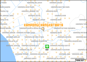
Kampong Changkat Baya (Kedah, Malaysia)Kampong Changkat Baya is a town in the Kedah region of Malaysia. An overview map of the region around Kampong Changkat Baya is displayed below.
regional and 3d topo map of Kampong Changkat Baya, Malaysia ::
Kampong Changkat Baya airports ::
The nearest airport is AOR - Alor Setar Sultan Abdul Halim, located 6.9 km south of Kampong Changkat Baya.
Other airports nearby include LGK - Pulau Langkawi Intl (73.0 km west), HDY - Songkhla Hat Yai Intl (75.6 km north), PAN - Pattani (103.8 km north east), PEN - Penang Intl (106.0 km south), Nearby towns ::
Kampong Changkat (0.0km north) //
Kampong Tok Mat Ali (0.0km north) //
Kampong Telok Malek (0.0km north) //
Kampong Budi (1.8km west) //
Kampong Huma (1.8km west) //
Kampong Raja (1.8km west) //
Kampong Pulau Kaim (1.9km north) //
Kampong Changkat (1.9km north) //
Kampong Pulau Pisang (1.9km north) //
Kampong Machang (1.9km north) //
Kampong Parit Letah (1.8km east) //
Kampong Pulau Dudor (1.8km east) //
Kampong Chegar (1.8km east) //
Kampong Tanjong Kapur (1.8km east) //
Kampong Telaga Batu (2.6km south west) //
Kampong Pulau Timbul (2.6km north west) //
Kampong Baharu (2.6km north west) //
Kampong Tanjong Kapor (2.6km south east) //
Kampong Rimba (2.6km north east) //
Kampong Padang Pekan (2.6km south east) //
Kampong Lubok Kawah (2.6km south east) //
Kampong Pulau Kechil (3.7km north) //
Kampong Pasir (3.7km south) //
Kampong Bohor (3.7km south) //
Kampong Rumput Minyak (3.7km north) //
Kampong Pulau Nyior (3.7km north) //
Kampong Telok Keluang (3.7km north) //
Kampong Belukar (3.7km east) //
Padang Bingal (4.1km north west) //
[all distances 'as the bird flies' and approximate]  Places with similar names to Kampong Changkat Baya, Malaysia ::
// Kampong Changkat Bacti (MY)
// Kampong Changkat Bai (MY)
// Kampong Changkat Bakti (MY)
// Kampong Changkat Belangkor (MY)
// Kampong Changkat Berangan (MY)
// Kampong Changkat Ibol (MY)
Disclaimer :: Information on this page comes without warranty of any kind |
||
|
Where is Kampong Changkat Baya? Elevation and coordinates ::
Latitude (lat): 6°15'0"N Longitude (lon): 100°23'0"E
Elevation (approx.): 5m (map arrows pan, magnifying glasses zoom) |
||
|
Visiting Kampong Changkat Baya? Hotel/Accommodation ::
Book a hotel in Kampong Changkat Baya Travel Guide ::
Buy a travel guide for Malaysia rental cars ::
car rental offers GPS waypoint ::
download a GPX waypoint (PoI) of Kampong Changkat Baya for your GPS receiver
|
||