|
search place name
|
||
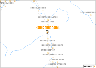
Kampong Dadu (Kelantan, Malaysia)Kampong Dadu is a town in the Kelantan region of Malaysia. An overview map of the region around Kampong Dadu is displayed below.
regional and 3d topo map of Kampong Dadu, Malaysia ::
Kampong Dadu airports ::
The nearest airport is KBR - Kota Bahru Sultan Ismail Petra, located 78.9 km north east of Kampong Dadu.
Other airports nearby include NAW - Narathiwat (104.7 km north), TGG - Kuala Terengganu Sultan Mahmud (137.0 km east), IPH - Ipoh Sultan Azlan Shah (142.5 km south west), PAN - Pattani (155.6 km north west), Nearby towns ::
Kampung Lubuk Bongor (1.9km south) //
Kampong Jebang (3.7km south) //
Kampung Timur (3.7km north) //
Kampong Jabir (4.1km south east) //
Kampong Pasir Dusun (5.6km north) //
Kampung Bunga Tanjung (5.9km south) //
Kampong Pulau Tiga (5.9km south) //
Kampong Setap (7.4km south) //
Kampong Kubor Datu (7.4km south) //
[all distances 'as the bird flies' and approximate] 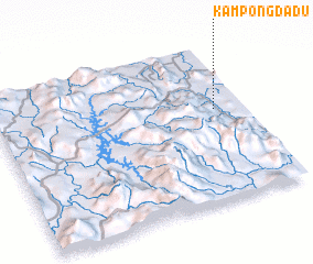 Places with similar names to Kampong Dadu, Malaysia ::
Disclaimer :: Information on this page comes without warranty of any kind |
||
|
Where is Kampong Dadu? Elevation and coordinates ::
Latitude (lat): 5°35'0"N Longitude (lon): 101°53'0"E
Elevation (approx.): 62m (map arrows pan, magnifying glasses zoom) |
||
|
Visiting Kampong Dadu? Hotel/Accommodation ::
Book a hotel in Kampong Dadu Travel Guide ::
Buy a travel guide for Malaysia rental cars ::
car rental offers GPS waypoint ::
download a GPX waypoint (PoI) of Kampong Dadu for your GPS receiver
|
||