|
search place name
|
||
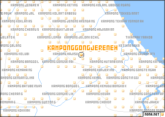
Kampong Gong Jereneh (Kelantan, Malaysia)Kampong Gong Jereneh is a town in the Kelantan region of Malaysia. An overview map of the region around Kampong Gong Jereneh is displayed below.
regional and 3d topo map of Kampong Gong Jereneh, Malaysia ::
Kampong Gong Jereneh airports ::
The nearest airport is KBR - Kota Bahru Sultan Ismail Petra, located 36.4 km north of Kampong Gong Jereneh.
Other airports nearby include TGG - Kuala Terengganu Sultan Mahmud (95.0 km south east), NAW - Narathiwat (102.5 km north west), PAN - Pattani (170.9 km north west), KTE - Kerteh (185.6 km south east), Nearby towns ::
Kampong Guntong (0.0km north) //
Kampong Gong Nara (0.0km north) //
Kampong Hutan Jering (0.0km north) //
Kampong Merkang (1.8km west) //
Kampong Jereneh (1.8km west) //
Kampong Padang Pak Amat (1.8km west) //
Kampong Nara (1.9km north) //
Kampong Alor Pasir (1.9km south) //
Kampong Wakaf Berangan (1.9km south) //
Kampong Jerat Samata (1.8km east) //
Kampong Gong Tasik (1.8km east) //
Kampong Cherang Tuli (2.6km south west) //
Kampong Kelubi (2.6km south east) //
Kampong Sahari Bulan (2.6km north east) //
Pasir Puteh (2.6km south east) //
Kampong Banggol Pertang (2.6km south east) //
Kampong Dalam Huma (2.6km south east) //
Kampong Gong Jelor (2.6km north east) //
Kampong Banggol Kerian (2.6km south east) //
Kampong Machang Manis (2.6km north east) //
Kampong Chengal Batu (3.7km south) //
Kampong Saring (3.7km south) //
Kampong Gong Pauh (3.7km north) //
Kampong Bukit Kayu Tinggi (3.7km north) //
Kampong Bukit Tok Boh (3.7km north) //
Kampong Gong Pepijat (3.7km north) //
Kampong Jelor Kechil (3.7km north) //
Kampong Haji Su (3.7km west) //
Kampong Tok Yakob (3.7km west) //
[all distances 'as the bird flies' and approximate] 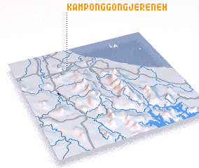 Places with similar names to Kampong Gong Jereneh, Malaysia :: Disclaimer :: Information on this page comes without warranty of any kind |
||
|
Where is Kampong Gong Jereneh? Elevation and coordinates ::
Latitude (lat): 5°51'0"N Longitude (lon): 102°23'0"E
Elevation (approx.): 8m (map arrows pan, magnifying glasses zoom) |
||
|
Visiting Kampong Gong Jereneh? Hotel/Accommodation ::
Book a hotel in Kampong Gong Jereneh Travel Guide ::
Buy a travel guide for Malaysia rental cars ::
car rental offers GPS waypoint ::
download a GPX waypoint (PoI) of Kampong Gong Jereneh for your GPS receiver
|
||