|
search place name
|
||
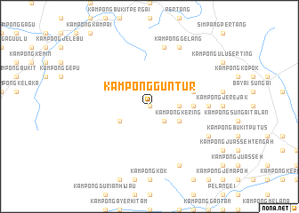
Kampong Guntur (Negeri Sembilan, Malaysia)Kampong Guntur is a town in the Negeri Sembilan region of Malaysia. An overview map of the region around Kampong Guntur is displayed below.
regional and 3d topo map of Kampong Guntur, Malaysia ::
Kampong Guntur airports ::
The nearest airport is KUL - Kuala Lumpur Intl, located 54.3 km west of Kampong Guntur.
Other airports nearby include MKZ - Malacca (67.1 km south), KUA - Kuantan (152.0 km north east), DUM - Dumai Pinang Kampai (162.1 km south west), JHB - Johor Bahru Sultan Ismail (213.8 km south east), Nearby towns ::
Kampong Kasau (0.0km north) //
Kampong Tengkek (2.6km south east) //
Kampong Tengah (3.7km east) //
Kampong Majau (3.7km east) //
Kampung Langkap (4.1km south west) //
Kampong Kering (4.1km south east) //
Kampong Tapak (5.6km east) //
Kampong Bukit (5.6km east) //
Kampong Rhalip (5.9km east) //
Kampong Padang Lebar (7.4km east) //
Kampong Birah (7.4km east) //
Kampong Mungkah (7.4km east) //
Kampong Durian Tawar (7.6km north) //
Kampong Gelang (8.3km north east) //
Kampong Palang (8.3km north east) //
Kampong Pasir Ambor (8.3km south east) //
Kampung Baharu Parit Tinggi (8.3km south east) //
[all distances 'as the bird flies' and approximate] 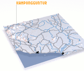 Places with similar names to Kampong Guntur, Malaysia :: Disclaimer :: Information on this page comes without warranty of any kind |
||
|
Where is Kampong Guntur? Elevation and coordinates ::
Latitude (lat): 2°52'0"N Longitude (lon): 102°11'0"E
Elevation (approx.): 136m (map arrows pan, magnifying glasses zoom) |
||
|
Visiting Kampong Guntur? Hotel/Accommodation ::
Book a hotel in Kampong Guntur Travel Guide ::
Buy a travel guide for Malaysia rental cars ::
car rental offers GPS waypoint ::
download a GPX waypoint (PoI) of Kampong Guntur for your GPS receiver
|
||