|
search place name
|
||
Kampong Keting (Kelantan, Malaysia)Kampong Keting is a town in the Kelantan region of Malaysia. An overview map of the region around Kampong Keting is displayed below.
regional and 3d topo map of Kampong Keting, Malaysia ::

Kampong Keting airports ::
The nearest airport is KBR - Kota Bahru Sultan Ismail Petra, located 24.8 km north of Kampong Keting.
Other airports nearby include NAW - Narathiwat (92.1 km north west), TGG - Kuala Terengganu Sultan Mahmud (104.4 km south east), PAN - Pattani (161.4 km north west), KTE - Kerteh (196.6 km south east), Nearby towns ::
Kampong Tok Junoh (1.8km west) //
Kampong Teratak Batang (1.8km west) //
Kampong Tengku Muda (1.8km west) //
Kampong Pak Mesenik (1.9km north) //
Kampong Sering (1.9km north) //
Kampong Kedai Menanti (1.9km south) //
Kampong Kubang Berulat (1.8km east) //
Kampong Kolam Tembesu (2.6km south west) //
Kampong Bukit Temalong (2.6km north west) //
Kampong Bukit Kechik (2.6km north east) //
Kampong Kubang Telaga (2.6km south east) //
Kampong Gong Pak Mali (2.6km south east) //
Kampong Pak Badol (3.7km west) //
Kampong Gunong (3.7km north) //
Kampong Lubok Tualang (3.7km south) //
Kampong Tualang Rendah (3.7km south) //
Kampong Tualang Tinggi (3.7km south) //
Kampong Panchor (3.7km north) //
Kampong Pepening (3.7km east) //
Kampong Haji Bowek (3.7km east) //
Kampong Wakaf Bunut (4.1km south west) //
Kampong Permatang Pusu (4.1km north west) //
Kampong Bukit Tanah (4.1km south west) //
Kampong Setol (4.1km south west) //
Kampong Bukit Hanyut (4.1km north west) //
Kampong Permatang Piah (4.1km south west) //
Kampong Alor Bakat (4.1km north west) //
Kampong Simpang Tiga Tegayong (4.1km north west) //
Kampong Jenereh Rendang (4.1km south east) //
[all distances 'as the bird flies' and approximate] 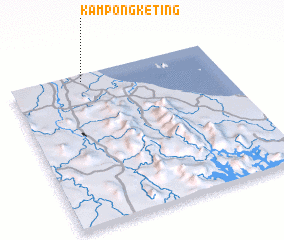 Places with similar names to Kampong Keting, Malaysia ::
// Kampong Kutang (MY)
// Kampong Kiudang (BN)
// Kampong Katong (MY)
// Kampong Kedang (MY)
// Kampong Kedang (MY)
// Kampong Kedaong (MY)
// Kampong Kodiang (MY)
Disclaimer :: Information on this page comes without warranty of any kind |
||
|
Where is Kampong Keting? Elevation and coordinates ::
Latitude (lat): 5°57'0"N Longitude (lon): 102°21'0"E
Elevation (approx.): 5m (map arrows pan, magnifying glasses zoom) |
||
|
Visiting Kampong Keting? Hotel/Accommodation ::
Book a hotel in Kampong Keting Travel Guide ::
Buy a travel guide for Malaysia rental cars ::
car rental offers GPS waypoint ::
download a GPX waypoint (PoI) of Kampong Keting for your GPS receiver
|
||