|
search place name
|
||
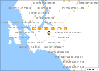
Kampong Lumut Kiri (Perak, Malaysia)Kampong Lumut Kiri is a town in the Perak region of Malaysia. An overview map of the region around Kampong Lumut Kiri is displayed below.
regional and 3d topo map of Kampong Lumut Kiri, Malaysia ::
Kampong Lumut Kiri airports ::
The nearest airport is IPH - Ipoh Sultan Azlan Shah, located 59.7 km north east of Kampong Lumut Kiri.
Other airports nearby include PEN - Penang Intl (127.7 km north), KUL - Kuala Lumpur Intl (198.7 km south east), AOR - Alor Setar Sultan Abdul Halim (220.5 km north), MKZ - Malacca (277.5 km south east), Nearby towns ::
Sitiawan (1.8km east) //
Kampong Bakar Bata (2.6km north west) //
Simpang Lima (2.6km north east) //
Kampong Serdang (2.6km north east) //
Kampong Batu Tiga (2.6km south west) //
Kampong Sungai Sitiawan (3.7km north) //
Kampong China (3.7km south) //
Kampong Selamat (3.7km east) //
Kampong Pundut (4.1km south west) //
Kampung Sitiawan (4.1km north east) //
Kampong Jelutong (4.1km north east) //
Kampong Deralik (4.1km north east) //
Kampung Koh (4.1km south east) //
Kampong Pak Melan (5.2km north west) //
Kampung Permatang (5.2km south west) //
Kampong Permatang (5.2km south west) //
Kampong Sungai Wangi (5.2km north east) //
Kampong Tebing Rabak (5.5km west) //
Kampong Telok Penchalang (5.6km south) //
Lumut (5.8km west) //
Kampong Lalang (5.9km north) //
Kampung Gajah Mati (5.9km north) //
Simpang Dua (5.8km east) //
Kampung Pasir Panjang Laut (5.9km south) //
Kampong Sungai Parit (5.9km south) //
Kampung Sungai Limau (5.9km south) //
Kampung Sungai Parit (5.9km south) //
Kampung Padang (6.7km south west) //
Kampong Tebok Haji Mar Ulu (6.7km north east) //
[all distances 'as the bird flies' and approximate] 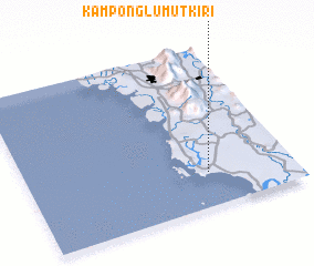 Places with similar names to Kampong Lumut Kiri, Malaysia :: Disclaimer :: Information on this page comes without warranty of any kind |
||
|
Where is Kampong Lumut Kiri? Elevation and coordinates ::
Latitude (lat): 4°13'0"N Longitude (lon): 100°41'0"E
Elevation (approx.): 5m (map arrows pan, magnifying glasses zoom) |
||
|
Visiting Kampong Lumut Kiri? Hotel/Accommodation ::
Book a hotel in Kampong Lumut Kiri Travel Guide ::
Buy a travel guide for Malaysia rental cars ::
car rental offers GPS waypoint ::
download a GPX waypoint (PoI) of Kampong Lumut Kiri for your GPS receiver
|
||