|
search place name
|
||
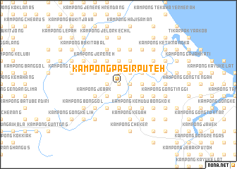
Kampong Pasir Puteh (Kelantan, Malaysia)Kampong Pasir Puteh is a town in the Kelantan region of Malaysia. An overview map of the region around Kampong Pasir Puteh is displayed below.
regional and 3d topo map of Kampong Pasir Puteh, Malaysia ::
Kampong Pasir Puteh airports ::
The nearest airport is KBR - Kota Bahru Sultan Ismail Petra, located 40.5 km north of Kampong Pasir Puteh.
Other airports nearby include TGG - Kuala Terengganu Sultan Mahmud (91.5 km south east), NAW - Narathiwat (106.4 km north west), PAN - Pattani (174.6 km north west), KTE - Kerteh (181.6 km south east), Nearby towns ::
Kampong Merbul (0.0km north) //
Kampong Raja (0.0km north) //
Kampong Nering (0.0km north) //
Kampong Dalam Huma (1.9km north) //
Kampong Kelubi (1.9km north) //
Pasir Puteh (1.9km north) //
Kampong Banggol Kerian (1.9km north) //
Kampong Banggol Pertang (1.9km north) //
Kampong Wakaf Bunut (1.8km east) //
Kampong Kok Jering (1.8km east) //
Kampong Kemal (1.9km south) //
Kampong Batas Besar (1.9km south) //
Kampong Saring (1.8km west) //
Kampong Chengal Batu (1.8km west) //
Kampong Gong Chapai (2.6km north east) //
Kampong Baharu (2.6km north east) //
Kampong Gong Kuar (2.6km north east) //
Kampong Gong Sopa (2.6km north east) //
Kampong Alor Pasir (2.6km north west) //
Kampong Wakaf Berangan (2.6km north west) //
Simpang Tiga Gaal (2.6km south east) //
Kampong Tasek (2.6km south east) //
Kampong Gaal (2.6km south east) //
Kampong Lembah (2.6km south west) //
Kampong Petani (2.6km south west) //
Kampong Pengkalan Pauh (2.6km south west) //
Kampong Wakaf Tuku (2.6km south west) //
Kampong Gong Rengas (3.7km east) //
Kampong Gong Ngah (3.7km east) //
[all distances 'as the bird flies' and approximate] 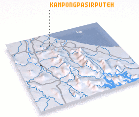 Places with similar names to Kampong Pasir Puteh, Malaysia ::
// Kampong Pasir Puteh (MY)
// Kampong Pasir Puteh (MY)
// Kampong Pasir Puteh (MY)
// Kampong Pasir Puteh (MY)
// Kampong Pasir Puteh (MY)
// Kampong Pasir Puteh (MY)
// Kampong Pasir Puteh (MY)
// Kampong Pasir Puteh (MY)
// Kampung Pasir Puteh (MY)
// Kampung Pasir Putih (MY)
Disclaimer :: Information on this page comes without warranty of any kind |
||
|
Where is Kampong Pasir Puteh? Elevation and coordinates ::
Latitude (lat): 5°49'0"N Longitude (lon): 102°24'0"E
Elevation (approx.): 20m (map arrows pan, magnifying glasses zoom) |
||
|
Visiting Kampong Pasir Puteh? Hotel/Accommodation ::
Book a hotel in Kampong Pasir Puteh Travel Guide ::
Buy a travel guide for Malaysia rental cars ::
car rental offers GPS waypoint ::
download a GPX waypoint (PoI) of Kampong Pasir Puteh for your GPS receiver
|
||