|
search place name
|
||
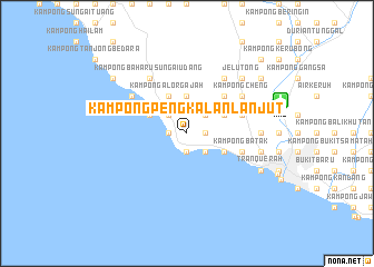
Kampong Pengkalan Lanjut (Melaka, Malaysia)Kampong Pengkalan Lanjut is a town in the Melaka region of Malaysia. An overview map of the region around Kampong Pengkalan Lanjut is displayed below.
regional and 3d topo map of Kampong Pengkalan Lanjut, Malaysia ::
Kampong Pengkalan Lanjut airports ::
The nearest airport is MKZ - Malacca, located 10.0 km east of Kampong Pengkalan Lanjut.
Other airports nearby include KUL - Kuala Lumpur Intl (76.1 km north west), DUM - Dumai Pinang Kampai (106.8 km south west), JHB - Johor Bahru Sultan Ismail (179.6 km east), KUA - Kuantan (206.2 km north east), Nearby towns ::
Kampong Lereh (1.9km south) //
Kampong Tanjong Keling (1.9km south) //
Kampong Pinang (1.9km east) //
Kampong Bukit Darat (1.9km west) //
Kampong Gelam (1.9km west) //
Kampong Pengkalan Perigi (1.9km west) //
Kampong Batang Tiga (2.6km south east) //
Bukit Rambai (2.6km north east) //
Tangga Batu (2.6km north west) //
Kampong Ayer Salak (3.7km north) //
Kelebang Besar (4.1km south east) //
Kampong Tengah (4.1km north east) //
Kampong Bukit Rambai (4.1km north east) //
Kampong Tengah (4.1km north west) //
Kampong Pantai Dusun (4.1km north west) //
Kampong Pantai Kundor (4.1km north west) //
Kampong Alor Gajah (4.1km north west) //
Sungai Udang (4.1km north west) //
Kampong Paya Rumput (4.1km north west) //
Kampong Tanjong Minyak (5.2km north east) //
Kampong Padang (5.9km east) //
Limbongan (5.9km east) //
Kampong Batak (5.9km east) //
Kampong Bertam (5.9km east) //
Kampong Ayer Supai (6.7km north east) //
Bertam Ulu (6.7km north east) //
Kampong Alor (6.7km north east) //
Kampong Sungai Udang (6.7km north west) //
Kampong Baharu Sungai Udang (6.7km north west) //
[all distances 'as the bird flies' and approximate] 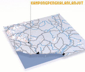 Places with similar names to Kampong Pengkalan Lanjut, Malaysia ::
// Kampong Pangkalan Empat (MY)
// Kampong Pangkalan Kuap (MY)
// Kampong Pangkal Nering (MY)
// Kampong Pangkal Nering (MY)
// Kampong Pengkalan (MY)
// Kampong Pengkalan (MY)
// Kampong Pengkalan (MY)
// Kampong Pengkalan (MY)
// Kampong Pengkalan (MY)
// Kampong Pengkalan Ajal (MY)
Disclaimer :: Information on this page comes without warranty of any kind |
||
|
Where is Kampong Pengkalan Lanjut? Elevation and coordinates ::
Latitude (lat): 2°14'0"N Longitude (lon): 102°10'0"E
Elevation (approx.): 7m (map arrows pan, magnifying glasses zoom) |
||
|
Visiting Kampong Pengkalan Lanjut? Hotel/Accommodation ::
Book a hotel in Kampong Pengkalan Lanjut Travel Guide ::
Buy a travel guide for Malaysia rental cars ::
car rental offers GPS waypoint ::
download a GPX waypoint (PoI) of Kampong Pengkalan Lanjut for your GPS receiver
|
||