|
search place name
|
||
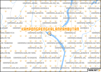
Kampong Pengkalan Rambutan (Kelantan, Malaysia)Kampong Pengkalan Rambutan is a town in the Kelantan region of Malaysia. An overview map of the region around Kampong Pengkalan Rambutan is displayed below.
regional and 3d topo map of Kampong Pengkalan Rambutan, Malaysia ::
Kampong Pengkalan Rambutan airports ::
The nearest airport is KBR - Kota Bahru Sultan Ismail Petra, located 21.7 km north east of Kampong Pengkalan Rambutan.
Other airports nearby include NAW - Narathiwat (72.7 km north west), TGG - Kuala Terengganu Sultan Mahmud (125.2 km south east), PAN - Pattani (140.7 km north west), AOR - Alor Setar Sultan Abdul Halim (196.7 km west), Nearby towns ::
Kampong Betong (1.9km north) //
Kampong Padang Chenok (1.9km north) //
Kampong Surau (1.8km east) //
Kampong Pengkalan Kubor (1.8km east) //
Kampong Kabu (1.8km west) //
Kampong Lubok Tapah (1.8km west) //
Kampong Kelar Binjai (1.9km south) //
Kampong Laka (1.9km south) //
Kampong Kelar (1.9km south) //
Kampong Gua (2.6km north east) //
Kampong Kubang Rawa (2.6km north east) //
Kampong Pasir Mas (2.6km north west) //
Kampong Pak Limah (2.6km north west) //
Kampong Kangkong (2.6km south east) //
Kampong Chicha Tinggi (2.6km south west) //
Kampong Bemban (2.6km south west) //
Kampong Kasar (3.7km north) //
Kampong Landa (3.7km north) //
Kampong Kubang Badak (3.7km north) //
Kampong Paya (3.7km east) //
Kampong Padang Tengah (3.7km east) //
Kampong Julong (3.7km west) //
Kampong Gelam (3.7km south) //
Kampong Binjai (3.7km south) //
Kampong Hutan Pasir (4.1km north east) //
Kampong Pak Kar (4.1km north east) //
Kampong Telok Chengal (4.1km north east) //
Kampong Gias (4.1km south east) //
Kampong Lundang Paku (4.1km south east) //
[all distances 'as the bird flies' and approximate] 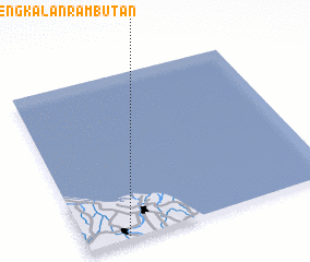 Places with similar names to Kampong Pengkalan Rambutan, Malaysia ::
// Kampong Pangkalan Empat (MY)
// Kampong Pangkalan Kuap (MY)
// Kampong Pangkal Nering (MY)
// Kampong Pangkal Nering (MY)
// Kampong Pengkalan (MY)
// Kampong Pengkalan (MY)
// Kampong Pengkalan (MY)
// Kampong Pengkalan (MY)
// Kampong Pengkalan (MY)
// Kampong Pengkalan Ajal (MY)
Disclaimer :: Information on this page comes without warranty of any kind |
||
|
Where is Kampong Pengkalan Rambutan? Elevation and coordinates ::
Latitude (lat): 6°1'0"N Longitude (lon): 102°10'0"E
Elevation (approx.): 7m (map arrows pan, magnifying glasses zoom) |
||
|
Visiting Kampong Pengkalan Rambutan? Hotel/Accommodation ::
Book a hotel in Kampong Pengkalan Rambutan Travel Guide ::
Buy a travel guide for Malaysia rental cars ::
car rental offers GPS waypoint ::
download a GPX waypoint (PoI) of Kampong Pengkalan Rambutan for your GPS receiver
|
||