|
search place name
|
||
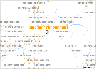
Kampong Seberang Wat (Kedah, Malaysia)Kampong Seberang Wat is a town in the Kedah region of Malaysia. An overview map of the region around Kampong Seberang Wat is displayed below.
regional and 3d topo map of Kampong Seberang Wat, Malaysia ::
Kampong Seberang Wat airports ::
The nearest airport is AOR - Alor Setar Sultan Abdul Halim, located 81.5 km north west of Kampong Seberang Wat.
Other airports nearby include PEN - Penang Intl (84.4 km south west), PAN - Pattani (124.3 km north), IPH - Ipoh Sultan Azlan Shah (124.6 km south), NAW - Narathiwat (128.8 km north east), Nearby towns ::
Kampong Kubu Tanah (0.0km north) //
Kampong Simpang Ampat (0.0km north) //
Kampong Pantai (1.8km west) //
Kampong Sungai Batu (1.8km west) //
Kampong Mata Ayer (1.8km west) //
Kampong Bawah Gunong (1.8km west) //
Kampong Haji Abas (1.8km west) //
Kampong Seberang Pekan (1.8km west) //
Kampong Banggol (1.9km north) //
Baling (2.6km south west) //
Kampong Pokok Sena (2.6km south west) //
Kampong Bongor Tiga (2.6km north west) //
Kampong Masjid (2.6km north west) //
Kampong Jeral (2.6km north west) //
Kampong Padang Temu (2.6km north west) //
Kampong Bakar Bata (2.6km north west) //
Kampong Toh Tih (2.6km north west) //
Kampong Telok Kangar (2.6km north west) //
Kampong Nering (2.6km north west) //
Kampong Batu Bungor (2.6km north west) //
Kampong Banggol Pompong (2.6km north east) //
Kampong Rambong (2.6km north east) //
Kampong Dalam Wang (3.7km west) //
Kampong Telok Sungai Durian (3.7km north) //
Kampong Taduri (4.1km south west) //
Kampong Banggol Sentol (4.1km north west) //
Kampong Lahar (4.1km north west) //
Kampong Kaki Bukit (4.1km north east) //
Kampong Gabus (5.2km south west) //
[all distances 'as the bird flies' and approximate] 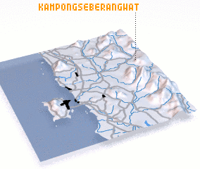 Places with similar names to Kampong Seberang Wat, Malaysia :: Disclaimer :: Information on this page comes without warranty of any kind |
||
|
Where is Kampong Seberang Wat? Elevation and coordinates ::
Latitude (lat): 5°41'0"N Longitude (lon): 100°56'0"E
Elevation (approx.): 95m (map arrows pan, magnifying glasses zoom) |
||
|
Visiting Kampong Seberang Wat? Hotel/Accommodation ::
Book a hotel in Kampong Seberang Wat Travel Guide ::
Buy a travel guide for Malaysia rental cars ::
car rental offers GPS waypoint ::
download a GPX waypoint (PoI) of Kampong Seberang Wat for your GPS receiver
|
||