|
search place name
|
||
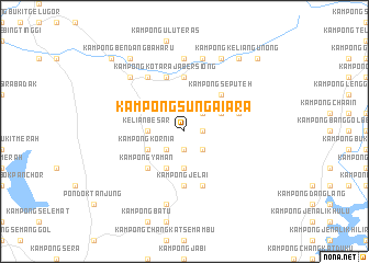
Kampong Sungai Ara (Perak, Malaysia)Kampong Sungai Ara is a town in the Perak region of Malaysia. An overview map of the region around Kampong Sungai Ara is displayed below.
regional and 3d topo map of Kampong Sungai Ara, Malaysia ::
Kampong Sungai Ara airports ::
The nearest airport is IPH - Ipoh Sultan Azlan Shah, located 63.1 km south east of Kampong Sungai Ara.
Other airports nearby include PEN - Penang Intl (65.0 km north west), AOR - Alor Setar Sultan Abdul Halim (132.6 km north), LGK - Pulau Langkawi Intl (184.5 km north west), NAW - Narathiwat (190.7 km north east), Nearby towns ::
Kampong Pulau Damar (1.8km east) //
Kampong Jemerang (1.9km south) //
Kampong Haji Mat Sek (2.6km north east) //
Kampong Pulau Damar (2.6km south east) //
Kampong Gudang (2.6km south west) //
Kampong Banggol Nering (2.6km south west) //
Kampong Relang (3.7km south) //
Kelian Besar (3.7km west) //
Kampong Charok Terap (4.1km north east) //
Kampong Pantai Besar (4.1km north east) //
Kampong Padang Das (4.1km south west) //
Kampong Kornia (4.1km south west) //
Kampong Batu Dua Puloh Satu (4.1km south west) //
Kampong Seputeh (5.2km north east) //
Kampong Tok Gagap (5.2km south west) //
Kampong Siam (5.2km south west) //
Kampong Yaman (5.2km south west) //
Kampong Jelai (5.6km south) //
Jelai (5.6km south) //
Kampong Ayer Gelugor (5.6km north) //
Kampong Hangu (5.6km south) //
Kampong Charok Dollah (5.8km east) //
Kampong Ayer Hitam (5.9km south) //
Kampong Kota Raja Bersiong (5.9km north) //
Kampong Kelian Tok Budi (5.9km north) //
Redang Panjang (6.7km north west) //
Kampong Redang Panjang (6.7km north west) //
Kampong Teras (7.4km north) //
Kampong Bendang Luas (7.4km north) //
[all distances 'as the bird flies' and approximate] 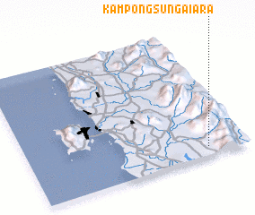 Places with similar names to Kampong Sungai Ara, Malaysia ::
// Kampong Sankir (MY)
// Kampong Senggora (MY)
// Kampong Sinkarei (MY)
// Kampong Sungai Ara (MY)
// Kampung Senggora (MY)
Disclaimer :: Information on this page comes without warranty of any kind |
||
|
Where is Kampong Sungai Ara? Elevation and coordinates ::
Latitude (lat): 5°4'0"N Longitude (lon): 100°49'0"E
Elevation (approx.): 51m (map arrows pan, magnifying glasses zoom) |
||
|
Visiting Kampong Sungai Ara? Hotel/Accommodation ::
Book a hotel in Kampong Sungai Ara Travel Guide ::
Buy a travel guide for Malaysia rental cars ::
car rental offers GPS waypoint ::
download a GPX waypoint (PoI) of Kampong Sungai Ara for your GPS receiver
|
||