|
search place name
|
||
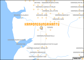
Kampong Sungai Hantu (Perak, Malaysia)Kampong Sungai Hantu is a town in the Perak region of Malaysia. An overview map of the region around Kampong Sungai Hantu is displayed below.
regional and 3d topo map of Kampong Sungai Hantu, Malaysia ::
Kampong Sungai Hantu airports ::
The nearest airport is IPH - Ipoh Sultan Azlan Shah, located 46.5 km east of Kampong Sungai Hantu.
Other airports nearby include PEN - Penang Intl (79.5 km north west), AOR - Alor Setar Sultan Abdul Halim (166.3 km north), LGK - Pulau Langkawi Intl (208.3 km north west), NAW - Narathiwat (230.5 km north east), Nearby towns ::
Kampong Terong (1.8km west) //
Kampong Salak (2.6km south east) //
Terung (3.7km east) //
Kampong Sungai Lubok (3.7km east) //
Kampong Punggor Ulu (4.1km south east) //
Kampong Batu Gelugor (5.2km north east) //
Kampong Jaha (5.6km north) //
Kampong Sendok (5.9km north) //
Kampong Changkat Ning (5.9km north) //
Kampong Matang Pasir (5.9km north) //
Kampong Ulu Sendok (6.7km north east) //
Kampong Sendok Ulu (6.7km north east) //
Kampong Perak (7.4km north) //
Kampong Temerloh (7.4km south) //
Kampung Cangkat Jering (7.6km north) //
Kampong Paya (7.6km north) //
Kampong Matang Gelugor (7.6km north) //
Kampong Baharu Ayer Terjun (7.6km south) //
Kampong Sungai Petai (7.8km north east) //
Kampong Changkat Ibol (7.8km north east) //
Kampong Jelutong (8.3km north east) //
Kampong Banggol Pasir (8.3km north east) //
Kampong Cheh (8.3km north east) //
Kampong Paya Tok Badak (9.2km north east) //
Kampong Bukit Gantang (10.5km north east) //
Kampong Bendang Nibong (10.5km north east) //
Kampong Kubu (10.5km north east) //
[all distances 'as the bird flies' and approximate] 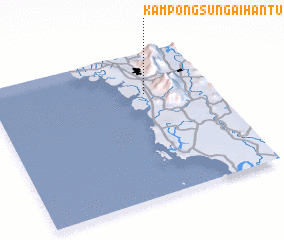 Places with similar names to Kampong Sungai Hantu, Malaysia ::
// Kampong Sungai Hantu (MY)
Disclaimer :: Information on this page comes without warranty of any kind |
||
|
Where is Kampong Sungai Hantu? Elevation and coordinates ::
Latitude (lat): 4°43'0"N Longitude (lon): 100°42'0"E
Elevation (approx.): 10m (map arrows pan, magnifying glasses zoom) |
||
|
Visiting Kampong Sungai Hantu? Hotel/Accommodation ::
Book a hotel in Kampong Sungai Hantu Travel Guide ::
Buy a travel guide for Malaysia rental cars ::
car rental offers GPS waypoint ::
download a GPX waypoint (PoI) of Kampong Sungai Hantu for your GPS receiver
|
||