|
search place name
|
||
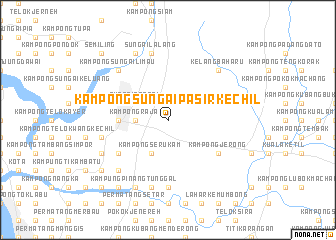
Kampong Sungai Pasir Kechil (Kedah, Malaysia)Kampong Sungai Pasir Kechil is a town in the Kedah region of Malaysia. An overview map of the region around Kampong Sungai Pasir Kechil is displayed below.
regional and 3d topo map of Kampong Sungai Pasir Kechil, Malaysia ::
Kampong Sungai Pasir Kechil airports ::
The nearest airport is PEN - Penang Intl, located 46.8 km south west of Kampong Sungai Pasir Kechil.
Other airports nearby include AOR - Alor Setar Sultan Abdul Halim (63.3 km north), LGK - Pulau Langkawi Intl (117.8 km north west), IPH - Ipoh Sultan Azlan Shah (133.1 km south east), HDY - Songkhla Hat Yai Intl (144.6 km north), Nearby towns ::
Kampong Raja (3.7km west) //
Kampong Jalan Kerbau (3.7km west) //
Kampong Serukam (4.1km south west) //
Sungai Petani (4.1km north west) //
Kampong Tongka (4.1km north west) //
Kampong Baru (5.5km west) //
Kampong Telok (5.8km west) //
Kampong Sungai Layar (5.8km west) //
Kampong Matang Tok Gedong (6.7km south west) //
Kampong Jerong (6.7km south east) //
Kampong Kuala Jerong (7.4km south) //
Kampong Padang (7.6km west) //
Kampong Sungai Pasir (7.6km west) //
Kampong Charok Klubi (7.6km west) //
Kampong Seberang Tok Soh (7.6km south) //
Sungai Lalang (7.6km north) //
Kampong Sungai Limau (7.8km north west) //
Kampong Matang Berangah (7.8km south west) //
Kelang Baharu (7.8km north east) //
Kampong Padang Temensu (8.3km south west) //
Kampung Pinang Tunggal (8.3km south west) //
Kampong Pinang (8.3km north west) //
Kampong Pokok Asam (9.2km south west) //
Kampong Matang Kedundong (9.3km south west) //
Tanjong Putus (10.5km south west) //
Kampong Jawa (10.5km south west) //
Semiling (10.5km north west) //
[all distances 'as the bird flies' and approximate] 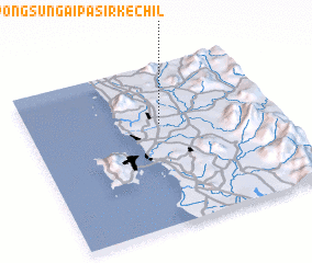 Places with similar names to Kampong Sungai Pasir Kechil, Malaysia ::
// Kampong Sungai Pasir (MY)
// Kampong Sungai Pasir (MY)
Disclaimer :: Information on this page comes without warranty of any kind |
||
|
Where is Kampong Sungai Pasir Kechil? Elevation and coordinates ::
Latitude (lat): 5°38'0"N Longitude (lon): 100°32'0"E
Elevation (approx.): 15m (map arrows pan, magnifying glasses zoom) |
||
|
Visiting Kampong Sungai Pasir Kechil? Hotel/Accommodation ::
Book a hotel in Kampong Sungai Pasir Kechil Travel Guide ::
Buy a travel guide for Malaysia rental cars ::
car rental offers GPS waypoint ::
download a GPX waypoint (PoI) of Kampong Sungai Pasir Kechil for your GPS receiver
|
||