|
search place name
|
||
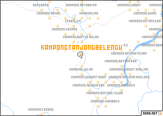
Kampong Tanjong Belengu (Pahang, Malaysia)Kampong Tanjong Belengu is a town in the Pahang region of Malaysia. An overview map of the region around Kampong Tanjong Belengu is displayed below.
regional and 3d topo map of Kampong Tanjong Belengu, Malaysia ::
Kampong Tanjong Belengu airports ::
The nearest airport is KUA - Kuantan, located 96.5 km north east of Kampong Tanjong Belengu.
Other airports nearby include KUL - Kuala Lumpur Intl (107.0 km south west), MKZ - Malacca (125.5 km south), KTE - Kerteh (168.7 km north east), IPH - Ipoh Sultan Azlan Shah (198.3 km north west), Nearby towns ::
Kampong Kuala Belengu (1.9km south) //
Kampong Tebing Tinggi (2.6km north west) //
Kampung Jelam (3.7km south) //
Kampong Seberang Jelam (3.7km south) //
Kampong Buntut Pulau (3.7km north) //
Kampong Pangsenam (3.7km north) //
Kampong Paya Kundang (4.1km north west) //
Kampong Lubok Kechik (4.1km north west) //
Kampong Tenggoh (4.1km north west) //
Kampong Manggis (5.6km north) //
Kampong Pulau Kujan (5.9km north) //
Kampong Belengu (5.9km west) //
Kampong Durian Tawar (5.9km south) //
Kampong Lanjut (5.9km south) //
Kampong Tanjong Batu (5.9km north) //
Kampong Guai (6.7km south east) //
Kampong Kempas (6.7km north west) //
Kampong Tanjong Kuran (6.7km south east) //
Kampung Mengkarak (7.6km south) //
Kampong Paya Kechik (7.6km north) //
Temerluh (7.6km north) //
Kampong Kemuning (7.6km east) //
Kampong Paya Kerinau (7.6km north) //
Kampong Seberang Guai (7.9km south east) //
Kampung Tualang (9.3km north west) //
Kampong Bukit Che Man (9.3km south east) //
Kampong Paya Panjang (9.3km south east) //
Kampong Aur Berduri (9.3km south east) //
Kampong Lubok Parap (9.3km south east) //
[all distances 'as the bird flies' and approximate] 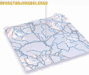 Places with similar names to Kampong Tanjong Belengu, Malaysia ::
// Kampong Tanjong Baharu (MY)
// Kampong Tanjong Bako (MY)
// Kampong Tanjong Balai (MY)
// Kampong Tanjong Balang (MY)
// Kampong Tanjong Batu (MY)
// Kampong Tanjong Batu (MY)
// Kampong Tanjong Batu (MY)
// Kampong Tanjong Batu (MY)
// Kampong Tanjong Batu (MY)
// Kampong Tanjong Batu (MY)
Disclaimer :: Information on this page comes without warranty of any kind |
||
|
Where is Kampong Tanjong Belengu? Elevation and coordinates ::
Latitude (lat): 3°23'0"N Longitude (lon): 102°26'0"E
Elevation (approx.): 40m (map arrows pan, magnifying glasses zoom) |
||
|
Visiting Kampong Tanjong Belengu? Hotel/Accommodation ::
Book a hotel in Kampong Tanjong Belengu Travel Guide ::
Buy a travel guide for Malaysia rental cars ::
car rental offers GPS waypoint ::
download a GPX waypoint (PoI) of Kampong Tanjong Belengu for your GPS receiver
|
||