|
search place name
|
||
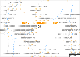
Kampong Tanjong Setar (Kedah, Malaysia)Kampong Tanjong Setar is a town in the Kedah region of Malaysia. An overview map of the region around Kampong Tanjong Setar is displayed below.
regional and 3d topo map of Kampong Tanjong Setar, Malaysia ::
Kampong Tanjong Setar airports ::
The nearest airport is AOR - Alor Setar Sultan Abdul Halim, located 58.0 km north west of Kampong Tanjong Setar.
Other airports nearby include PEN - Penang Intl (79.0 km south west), PAN - Pattani (115.4 km north), LGK - Pulau Langkawi Intl (128.1 km north west), HDY - Songkhla Hat Yai Intl (130.2 km north), Nearby towns ::
Kampong Paya (1.9km north) //
Kampong Bendang Penyengat (1.9km north) //
Kampong Belukar (1.9km north) //
Kampong Namek (1.9km north) //
Kampung Sadu (1.8km west) //
Kampong Lubok Bedil (1.8km west) //
Kampong Sik (1.8km west) //
Kampong Rambai (2.6km north east) //
Kampong Terus Labi (2.6km north east) //
Kampong Bukit (2.6km north east) //
Kampong Tebal (2.6km north east) //
Kampong Jerai (2.6km north east) //
Kampung Kuala Cepir (2.6km north east) //
Kampong Charok Kudang (2.6km north west) //
Kampong Dusun (2.6km north west) //
Kampong Charok Kit (2.6km north west) //
Kampong Bechah Pa' Baharu (2.6km south west) //
Kampong Tua (3.7km north) //
Kampong Kuala (3.7km west) //
Kampong Sena (3.7km west) //
Kampong Tanjong (3.7km west) //
Sik (3.7km west) //
Kampong Banggol Tambak (3.7km west) //
Kampong Belimbing (4.1km north east) //
Kampong Kubang (4.1km north east) //
Kampong Bunga (4.1km north east) //
Kampong Jelutong (4.1km north east) //
Kampong Jering (4.1km north east) //
Kampong Lalang (4.1km north east) //
[all distances 'as the bird flies' and approximate] 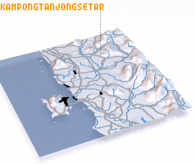 Places with similar names to Kampong Tanjong Setar, Malaysia ::
// Kampong Tanjong Asam (MY)
// Kampong Tanjong Sari (MY)
// Kampong Tanjong Seberang (MY)
// Kampong Tanjong Selabu (MY)
// Kampong Tanjong Semberong (MY)
// Kampong Tanjong Sena (MY)
// Kampong Tanjong Sena (MY)
// Kampong Tanjong Sentang (MY)
// Kampong Tanjong Serai (MY)
// Kampong Tanjong Serindet (MY)
Disclaimer :: Information on this page comes without warranty of any kind |
||
|
Where is Kampong Tanjong Setar? Elevation and coordinates ::
Latitude (lat): 5°49'0"N Longitude (lon): 100°46'0"E
Elevation (approx.): 85m (map arrows pan, magnifying glasses zoom) |
||
|
Visiting Kampong Tanjong Setar? Hotel/Accommodation ::
Book a hotel in Kampong Tanjong Setar Travel Guide ::
Buy a travel guide for Malaysia rental cars ::
car rental offers GPS waypoint ::
download a GPX waypoint (PoI) of Kampong Tanjong Setar for your GPS receiver
|
||