|
search place name
|
||
Kampong Telaga Tok Jering (Kedah, Malaysia)Kampong Telaga Tok Jering is a town in the Kedah region of Malaysia. An overview map of the region around Kampong Telaga Tok Jering is displayed below.
regional and 3d topo map of Kampong Telaga Tok Jering, Malaysia ::

Kampong Telaga Tok Jering airports ::
The nearest airport is AOR - Alor Setar Sultan Abdul Halim, located 14.6 km north of Kampong Telaga Tok Jering.
Other airports nearby include LGK - Pulau Langkawi Intl (74.7 km north west), PEN - Penang Intl (85.5 km south), HDY - Songkhla Hat Yai Intl (95.9 km north), PAN - Pattani (119.3 km north east), Nearby towns ::
Kampong Padang Tengah (0.0km north) //
Kampong Tengah (0.0km north) //
Kampong Telok Bagan (0.0km north) //
Kampong Hujong Alor (1.9km north) //
Kampong Lahar Pumpong (1.8km west) //
Kampong Pergam (1.8km west) //
Kampong Alor Ibus (1.8km west) //
Lahar Buloh (1.9km south) //
Kampong Lahar Buaya (1.9km south) //
Kampong Lahar Kabu (1.9km south) //
Lalang Kerbau (1.8km east) //
Titi Keling (1.8km east) //
Kampong Selarong (1.8km east) //
Kampong Telaga Tok Tong (2.6km north west) //
Kampong Padang Raja (2.6km north west) //
Kampong Hutan Putus (2.6km north west) //
Kampong Pengkalan Kundor (2.6km north east) //
Kampong Tandok (2.6km north east) //
Kampong Pokok Lepai (2.6km north east) //
Kampong Keriang Pulau (2.6km north east) //
Kampong Tebengau (2.6km south west) //
Kampong Kebun Pinang (2.6km south east) //
Kampong Selarong Balak (3.7km west) //
Kampong Akor Peluru (3.7km north) //
Tambak Bunga (3.7km north) //
Kampong Perlis (3.7km south) //
Kampong Lahar Buloh (3.7km south) //
Kampong Telok Bulang (3.7km south) //
Kampong Ujong Telok Kechal (4.1km north west) //
[all distances 'as the bird flies' and approximate] 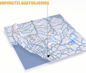 Places with similar names to Kampong Telaga Tok Jering, Malaysia :: Disclaimer :: Information on this page comes without warranty of any kind |
||
|
Where is Kampong Telaga Tok Jering? Elevation and coordinates ::
Latitude (lat): 6°4'0"N Longitude (lon): 100°21'0"E
Elevation (approx.): 4m (map arrows pan, magnifying glasses zoom) |
||
|
Visiting Kampong Telaga Tok Jering? Hotel/Accommodation ::
Book a hotel in Kampong Telaga Tok Jering Travel Guide ::
Buy a travel guide for Malaysia rental cars ::
car rental offers GPS waypoint ::
download a GPX waypoint (PoI) of Kampong Telaga Tok Jering for your GPS receiver
|
||