|
search place name
|
||
Kampong Uma (Terengganu, Malaysia)Kampong Uma is a town in the Terengganu region of Malaysia. An overview map of the region around Kampong Uma is displayed below.
regional and 3d topo map of Kampong Uma, Malaysia ::

Kampong Uma airports ::
The nearest airport is KTE - Kerteh, located 25.8 km south east of Kampong Uma.
Other airports nearby include TGG - Kuala Terengganu Sultan Mahmud (75.0 km north), KUA - Kuantan (106.4 km south), KBR - Kota Bahru Sultan Ismail Petra (193.9 km north west), NAW - Narathiwat (262.2 km north west), Nearby towns ::
Kampong Kuala Rasau (1.9km south) //
Kampong Pagar Dusun (1.8km west) //
Kampong Teku (1.8km west) //
Kampong Lubok Tok Jong (1.8km east) //
Kampong Ketapi Tinggal (2.6km south east) //
Kampung Luit (4.1km north west) //
Kampong Padang Ketapi (4.1km north west) //
Kampung Sungai Dua (5.2km south east) //
Kampong Lubok Pauh (5.2km south east) //
Kampong Ulu Luit (5.8km west) //
Kampong Gelugor (6.7km south west) //
Kampong Burong Baharu (7.6km north) //
Kampong Kumpal (7.6km north) //
Kemudi (7.6km north) //
Kumpal (7.6km north) //
Serdang (7.8km north east) //
Kampong Binjai (7.8km south west) //
Kampong Durian Mentangau (7.8km south east) //
Kampong Pak Rioh (7.8km north east) //
Kampong Pasir Besar (8.3km south west) //
Kampong Gelugor (8.3km south west) //
Kampong Bukit Bata (8.3km north east) //
Kampong Serdang (8.3km north east) //
Kampong Keliu (8.3km north east) //
Kampong Binjai (8.3km north east) //
Kampong Padang Pulut (9.3km north west) //
Kampong Pinang Jaya (9.3km north west) //
Kampong Durian Rendang (9.2km south east) //
Rengas Tujah (9.2km north east) //
[all distances 'as the bird flies' and approximate] 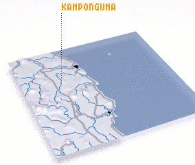 Places with similar names to Kampong Uma, Malaysia ::
// Kampong Mai (MY)
// Kampong Uma (MY)
// Kampong Uma (MY)
// Kampong Amo (BN)
// Kampong Gambau (MY)
// Kampong Giam (MY)
// Kampong Giam (MY)
// Kampong Gumai (MY)
// Kampong Gumbai (MY)
// Companugamu (BR)
Disclaimer :: Information on this page comes without warranty of any kind |
||
|
Where is Kampong Uma? Elevation and coordinates ::
Latitude (lat): 4°44'0"N Longitude (lon): 103°18'0"E
Elevation (approx.): 16m (map arrows pan, magnifying glasses zoom) |
||
|
Visiting Kampong Uma? Hotel/Accommodation ::
Book a hotel in Kampong Uma Travel Guide ::
Buy a travel guide for Malaysia rental cars ::
car rental offers GPS waypoint ::
download a GPX waypoint (PoI) of Kampong Uma for your GPS receiver
|
||