|
search place name
|
||
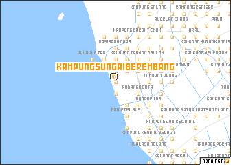
Kampung Sungai Berembang (Malaysia)Kampung Sungai Berembang is a town in Malaysia. An overview map of the region around Kampung Sungai Berembang is displayed below.
regional and 3d topo map of Kampung Sungai Berembang, Malaysia ::
Kampung Sungai Berembang airports ::
The nearest airport is AOR - Alor Setar Sultan Abdul Halim, located 33.7 km south east of Kampung Sungai Berembang.
Other airports nearby include LGK - Pulau Langkawi Intl (46.8 km west), HDY - Songkhla Hat Yai Intl (68.2 km north east), PEN - Penang Intl (119.1 km south), PAN - Pattani (120.3 km north east), Nearby towns ::
Kampung Sungai Simpang Tengar (0.0km north) //
Kampung Padang Besar (1.9km north) //
Sungai Berembang (1.9km south) //
Kampung Pulau (1.9km south) //
Kampong Tok Kaya Tua (2.6km north east) //
Kampung Telok (3.7km north) //
Kampung Behor Masjid (4.1km north east) //
Kampung Langgar Kayang (4.1km north east) //
Kampung Titi Serong (4.1km north east) //
Kampung Hutan Ibus (4.1km north east) //
Kampung Besar (4.1km north east) //
Kampong Langgar (4.1km north east) //
Permatang Pauh (4.1km south east) //
Padang Benta (4.1km south east) //
Kuala Perlis (4.1km north west) //
Kampung Ujong Tanjong (4.1km north west) //
Sungai Baharu (4.1km south east) //
Kampung Tanjong Buloh (5.2km north east) //
Kampung Behor Latch (5.2km north east) //
Pulau Ketam (5.2km north west) //
Simpang Empat (5.2km south east) //
Kampung Permatang Pauh (5.5km east) //
Nasi Sa Bungas (5.6km north) //
Kampung Binjai (5.8km east) //
Kampung Surau (5.8km east) //
Banir Tembus (5.9km south) //
Kampung Sungai Padang (5.9km south) //
Kampung Sungai Belati (5.9km south) //
Kampung Telaga Idi (5.9km north) //
[all distances 'as the bird flies' and approximate] 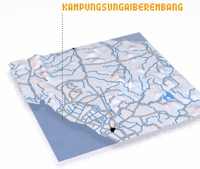 Places with similar names to Kampung Sungai Berembang, Malaysia :: Disclaimer :: Information on this page comes without warranty of any kind |
||
|
Where is Kampung Sungai Berembang? Elevation and coordinates ::
Latitude (lat): 6°22'0"N Longitude (lon): 100°9'0"E
Elevation (approx.): 4m (map arrows pan, magnifying glasses zoom) |
||
|
Visiting Kampung Sungai Berembang? Hotel/Accommodation ::
Book a hotel in Kampung Sungai Berembang Travel Guide ::
Buy a travel guide for Malaysia rental cars ::
car rental offers GPS waypoint ::
download a GPX waypoint (PoI) of Kampung Sungai Berembang for your GPS receiver
|
||