|
search place name
|
||
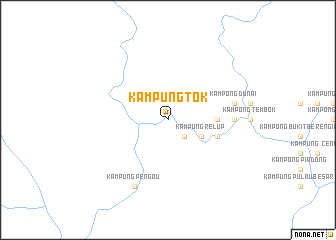
Kampung Tok (Pahang, Malaysia)Kampung Tok is a town in the Pahang region of Malaysia. An overview map of the region around Kampung Tok is displayed below.
regional and 3d topo map of Kampung Tok, Malaysia ::
Kampung Tok airports ::
The nearest airport is KTE - Kerteh, located 101.0 km east of Kampung Tok.
Other airports nearby include KUA - Kuantan (112.4 km south east), TGG - Kuala Terengganu Sultan Mahmud (115.8 km north east), IPH - Ipoh Sultan Azlan Shah (158.2 km west), KBR - Kota Bahru Sultan Ismail Petra (184.2 km north), Nearby towns ::
Kampong Samas (2.6km south east) //
Kampung Relup (4.1km south east) //
Kampong Kumit (5.5km east) //
Kampong Langgar (5.8km east) //
Kampong Murai (7.4km east) //
Kampong Dunai (7.6km east) //
Kampong Kuala Sat (7.6km east) //
Kampong Pagi (8.3km south west) //
Kampung Pengau (8.3km south west) //
[all distances 'as the bird flies' and approximate] 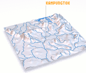 Places with similar names to Kampung Tok, Malaysia ::
// Kampong Takau (MY)
// Kampong Teka (MY)
// Kampong Tekka (MY)
// Kampong Teku (MY)
// Kampong Teku (MY)
// Kampong Tiga (MY)
// Kampong Tiku (MY)
// Kampong Tiku (MY)
// Kampong Tukai (MY)
// Kampung Gadik (MY)
Disclaimer :: Information on this page comes without warranty of any kind |
||
|
Where is Kampung Tok? Elevation and coordinates ::
Latitude (lat): 4°31'0"N Longitude (lon): 102°31'0"E
Elevation (approx.): 125m (map arrows pan, magnifying glasses zoom) |
||
|
Visiting Kampung Tok? Hotel/Accommodation ::
Book a hotel in Kampung Tok Travel Guide ::
Buy a travel guide for Malaysia rental cars ::
car rental offers GPS waypoint ::
download a GPX waypoint (PoI) of Kampung Tok for your GPS receiver
|
||