|
search place name
|
||
Petikal (Sarawak, Malaysia)Petikal is a town in the Sarawak region of Malaysia. An overview map of the region around Petikal is displayed below.
regional and 3d topo map of Petikal, Malaysia ::

Petikal airports ::
The nearest airport is SBW - Sibu, located 115.2 km north east of Petikal.
Other airports nearby include KCH - Kuching Intl (135.2 km west), SQC - Sintang Susilo (138.8 km south), BTU - Bintulu (258.2 km north east), Nearby towns ::
Aur (0.0km north) //
Isu (1.9km east) //
Bukong (2.6km north east) //
Kubal Batu (4.1km south west) //
Lidong (4.1km south west) //
Tanjong Bedegong (4.1km south west) //
Nyelutong (5.6km north) //
Kejemut (5.6km south) //
Tembawai Lubok (5.9km north) //
Kaong (6.7km south west) //
Rambai (6.7km south west) //
Saka (7.4km north) //
Tansang (7.6km north) //
Nanga Entaban (7.6km east) //
Engkamat (7.6km east) //
Pelasok (7.6km east) //
Tembong (7.6km south) //
Tisak (7.9km south west) //
Tembawai Lubok (8.3km north west) //
Remabong (8.3km north east) //
Tabut (8.3km south east) //
Pentik (8.3km south east) //
Balui (8.3km south east) //
Kampong Nanga Sekerang (9.3km south west) //
Tebarong (9.3km south east) //
Pematoh (10.5km north east) //
[all distances 'as the bird flies' and approximate] 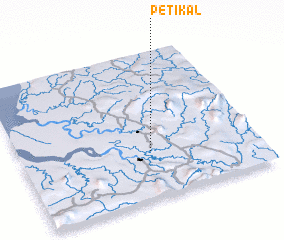 Places with similar names to Petikal, Malaysia ::
// Padaukhla (MM)
// Petkala (MM)
// Puttgolla (DE)
// Petaquilla (PA)
// Piedicolle (IT)
// Padegliai (LT)
// Puodkaliai (LT)
// Patküla (EE)
// Puduküla (EE)
// Podkula (BA)
Disclaimer :: Information on this page comes without warranty of any kind |
||
|
Where is Petikal? Elevation and coordinates ::
Latitude (lat): 1°19'0"N Longitude (lon): 111°33'0"E
Elevation (approx.): 24m (map arrows pan, magnifying glasses zoom) |
||
|
Visiting Petikal? Hotel/Accommodation ::
Book a hotel in Petikal Travel Guide ::
Buy a travel guide for Malaysia rental cars ::
car rental offers GPS waypoint ::
download a GPX waypoint (PoI) of Petikal for your GPS receiver
|
||