|
search place name
|
||
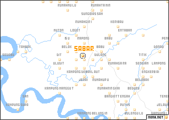
Sabar (Sarawak, Malaysia)Sabar is a town in the Sarawak region of Malaysia. An overview map of the region around Sabar is displayed below.
regional and 3d topo map of Sabar, Malaysia ::
Sabar airports ::
The nearest airport is SBW - Sibu, located 98.1 km north east of Sabar.
Other airports nearby include KCH - Kuching Intl (119.5 km west), SQC - Sintang Susilo (168.2 km south), BTU - Bintulu (246.7 km north east), Nearby towns ::
Debak (0.0km north) //
Terai (0.0km north) //
Debak (1.9km south) //
Lakis (1.9km south) //
Rumah Renggan (1.9km east) //
Rumah Luong (1.9km west) //
Rumah Garit (2.6km south west) //
Balasau (2.6km north west) //
Kampong Debak Laut (3.7km south) //
Dulang (3.7km east) //
Rumah Chuat (3.7km east) //
Rumah Entri (3.7km east) //
Rapong (3.7km north) //
Suri Debak (4.1km south east) //
Penunus (4.1km south east) //
Rimbas (4.1km north east) //
Babu (4.1km north east) //
Belok (4.1km north west) //
Isu (5.2km north west) //
Dit (5.6km west) //
Jerai (5.6km south) //
Teru (5.6km east) //
Ulu Dit (5.9km west) //
Rumah Gana (5.9km south) //
Loget (5.9km north) //
Surit Lalang (6.7km south east) //
Rumah Upu (6.7km south east) //
Babu (6.7km north east) //
Rumah Giri (7.4km north) //
[all distances 'as the bird flies' and approximate] 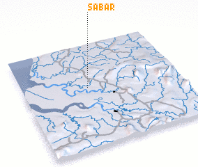 Places with similar names to Sabar, Malaysia ::
Disclaimer :: Information on this page comes without warranty of any kind |
||
|
Where is Sabar? Elevation and coordinates ::
Latitude (lat): 1°35'0"N Longitude (lon): 111°25'0"E
Elevation (approx.): 18m (map arrows pan, magnifying glasses zoom) |
||
|
Visiting Sabar? Hotel/Accommodation ::
Book a hotel in Sabar Travel Guide ::
Buy a travel guide for Malaysia rental cars ::
car rental offers GPS waypoint ::
download a GPX waypoint (PoI) of Sabar for your GPS receiver
|
||