|
search place name
|
||
Sandakan (Sabah, Malaysia)Sandakan is a town in the Sabah region of Malaysia. An overview map of the region around Sandakan is displayed below.
regional and 3d topo map of Sandakan, Malaysia ::

Sandakan airports ::
The nearest airport is LDU - Lahad Datu, located 91.5 km south of Sandakan.
Other airports nearby include TWU - Tawau (168.1 km south), Nearby towns ::
Buli Sim Sim (1.9km north) //
Kampung Gelam (1.8km west) //
Kampung Berhala Darat (2.6km north east) //
Kampong Tanah Merah (3.7km west) //
Kampong Ayer (4.1km south west) //
Kampong Baharu (5.8km west) //
Bokara (5.8km west) //
Berhala (5.9km north) //
Kampong Semangut (6.7km south east) //
[all distances 'as the bird flies' and approximate] 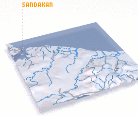 Places with similar names to Sandakan, Malaysia ::
// Sindawgon (MM)
// Sindegon (MM)
// Sindègon (MM)
// Sindègon (MM)
// Sondokan (MY)
// Sondokon (MY)
// Sindikianá (GR)
// San-Di-Gan (US)
// Santaquin (US)
// Sāndikona (BD)
Disclaimer :: Information on this page comes without warranty of any kind |
||
|
Where is Sandakan? Elevation and coordinates ::
Latitude (lat): 5°50'0"N Longitude (lon): 118°7'0"E
Elevation (approx.): -32768m (map arrows pan, magnifying glasses zoom) |
||
|
Visiting Sandakan? Hotel/Accommodation ::
Book a hotel in Sandakan Travel Guide ::
Buy a travel guide for Malaysia rental cars ::
car rental offers GPS waypoint ::
download a GPX waypoint (PoI) of Sandakan for your GPS receiver
|
||