|
search place name
|
||
Lazo (Bocas del Toro, Panama)Lazo is a town in the Bocas del Toro region of Panama. An overview map of the region around Lazo is displayed below.
regional and 3d topo map of Lazo, Panama ::

Lazo airports ::
The nearest airport is CHX - Changuinola Cap Manuel Nino Intl, located 23.4 km north of Lazo.
Other airports nearby include BOC - Bocas Del Toro Intl (27.4 km east), OTR - Coto 47 (89.4 km south west), DAV - David Enrique Malek Intl (95.2 km south), LIO - Limon Intl (98.1 km north west), Nearby towns ::
Risco Abajo (1.8km east) //
Rancho Chalango (4.1km south east) //
Aguadulce (4.1km north east) //
Orrete (4.1km south east) //
Ludobidi (5.8km east) //
Risco (5.8km east) //
Río Luis (5.8km east) //
Ojo de Agua (6.7km north east) //
Piedra Blanca (6.7km north east) //
Río Oeste Afuera (7.3km east) //
La Mina (7.4km south) //
Corriente Grande (7.8km north west) //
Milla Uno (9.2km north east) //
Milla Dos (9.2km north east) //
Fruitdale (9.2km north east) //
Milla Tres (10.4km north east) //
Milla Cuatro (10.4km north east) //
Isla Venado (10.4km north west) //
[all distances 'as the bird flies' and approximate] 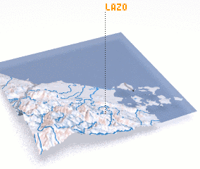 Places with similar names to Lazo, Panama ::
Disclaimer :: Information on this page comes without warranty of any kind |
||
|
Where is Lazo? Elevation and coordinates ::
Latitude (lat): 9°15'0"N Longitude (lon): 82°29'0"W
Elevation (approx.): 192m (map arrows pan, magnifying glasses zoom) |
||
|
Visiting Lazo? Hotel/Accommodation ::
Book a hotel in Lazo Travel Guide ::
Buy a travel guide for Panama rental cars ::
car rental offers GPS waypoint ::
download a GPX waypoint (PoI) of Lazo for your GPS receiver
|
||