|
search place name
|
||
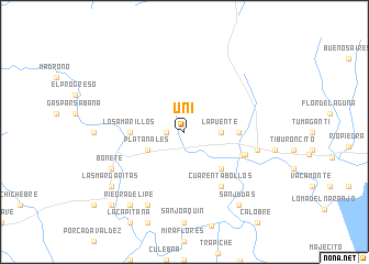
Uní (Panamá, Panama)Uní is a town in the Panamá region of Panama. An overview map of the region around Uní is displayed below.
regional and 3d topo map of Uní, Panama ::
Uní airports ::
The nearest airport is PTY - Panama City Tocumen Intl, located 44.1 km south west of Uní.
Other airports nearby include PAC - Panama Marcos A Gelabert Intl (65.9 km south west), HOW - Howard (73.1 km south west), Nearby towns ::
Unicito (1.8km west) //
La Palma (3.7km east) //
La Puente (3.7km east) //
Platanales (4.1km south west) //
El Llanito (5.2km south east) //
El Despreciado (5.5km east) //
Los Amarillos (5.5km west) //
El Llano (6.2km east) //
La Loma (6.5km east) //
Cuarenta Bollos (6.7km south east) //
Chimborazo (7.5km east) //
La Pita (8.3km south west) //
Bonete (8.2km south west) //
Piedra de Lipe (9.2km south west) //
San Judas (9.2km south east) //
Las Margaritas (9.2km south west) //
Loma del Río (10.4km south west) //
Boticario (10.4km south west) //
[all distances 'as the bird flies' and approximate] 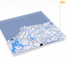 Places with similar names to Uní, Panama ::
Disclaimer :: Information on this page comes without warranty of any kind |
||
|
Where is Uní? Elevation and coordinates ::
Latitude (lat): 9°14'0"N Longitude (lon): 79°1'0"W
Elevation (approx.): 46m (map arrows pan, magnifying glasses zoom) |
||
|
Visiting Uní? Hotel/Accommodation ::
Book a hotel in Uní Travel Guide ::
Buy a travel guide for Panama rental cars ::
car rental offers GPS waypoint ::
download a GPX waypoint (PoI) of Uní for your GPS receiver
|
||