|
search place name
|
||
‘Abd ‘Alī (Al Qādisīyah, Iraq)‘Abd ‘Alī is a town in the Al Qādisīyah region of Iraq. An overview map of the region around ‘Abd ‘Alī is displayed below.
regional and 3d topo map of ‘Abd ‘Alī, Iraq ::

Nearby towns ::
Umm Khalāl (2.2km south) //
Abū Ţabīkh (3.9km south) //
Al Ḩamzah (4.0km north west) //
Şabīḩ Jabbār (5.9km north west) //
Rīkān (5.6km west) //
Wāḩid Ḩuzayrān (7.1km south west) //
‘Azīz Kazār (6.5km west) //
Injīl (7.1km south east) //
Ḩasan Āl Jazzār (7.6km north) //
As Samḩāt (6.9km south west) //
Salmān Āl ‘Ayţān (9.4km north west) //
‘Akş Āl Nāşir (9.4km south east) //
Ḩusayn Ibn Khunayfir (9.4km south east) //
‘Abd aţ Ţallāq (10.6km south east) //
[all distances 'as the bird flies' and approximate] 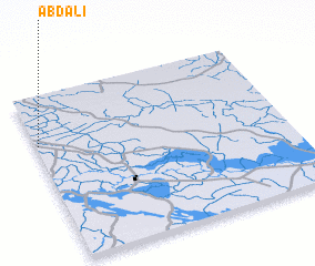 Places with similar names to ‘Abd ‘Alī, Iraq ::
Disclaimer :: Information on this page comes without warranty of any kind |
||
|
Where is ‘Abd ‘Alī? Elevation and coordinates ::
Latitude (lat): 31°42'7"N Longitude (lon): 45°0'34"E
Elevation (approx.): 20m (map arrows pan, magnifying glasses zoom) |
||
|
Visiting ‘Abd ‘Alī? Hotel/Accommodation ::
Book a hotel in ‘Abd ‘Alī Travel Guide ::
Buy a travel guide for Iraq rental cars ::
car rental offers GPS waypoint ::
download a GPX waypoint (PoI) of ‘Abd ‘Alī for your GPS receiver
|
||