|
search place name
|
||
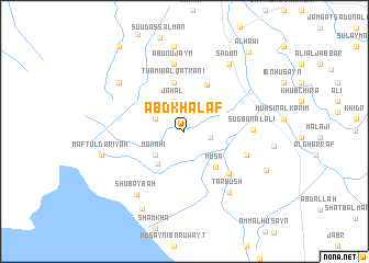
‘Abd Khalaf (Dhī Qār, Iraq)‘Abd Khalaf is a town in the Dhī Qār region of Iraq. An overview map of the region around ‘Abd Khalaf is displayed below.
regional and 3d topo map of ‘Abd Khalaf, Iraq ::
‘Abd Khalaf airports ::
The nearest airport is BSR - Basrah Intl, located 170.0 km south east of ‘Abd Khalaf.
Nearby towns ::
Sayyid Jabbār (2.3km east) //
Qal‘at Maryān (2.8km north west) //
Jahal (3.2km north) //
Abū Shifyat al Mar‘at (3.2km north) //
Manāḩī (3.5km south west) //
Āl Şayyāḩ (3.8km north east) //
Ḩasan al Baghdādī (4.0km south west) //
Mūsá (4.5km south east) //
Thāmir al Qaţranī (5.1km north) //
Albū Khulayf (5.1km north east) //
Marhash al Khuḑayyir (5.8km south east) //
‘Abd al Ḩusayn (6.0km south east) //
Abū Nujaym (6.9km north) //
Şugbān al ‘Alī (6.0km east) //
Ţarbūsh (7.3km south east) //
Shubaybah (7.6km south west) //
Sa‘dūn (7.8km north east) //
Ḩātim al Qaţranī (7.5km north west) //
Ḩusayn (8.7km north) //
Maftūl Dar‘īyah (7.6km west) //
Al Budūr (7.6km west) //
‘Abbās (8.7km south west) //
Farhūd al Ḩamad (8.2km south east) //
Al Ḩāwī (9.8km north east) //
Ālbū Kāmil (10.4km north west) //
[all distances 'as the bird flies' and approximate]  Places with similar names to ‘Abd Khalaf, Iraq :: Disclaimer :: Information on this page comes without warranty of any kind |
||
|
Where is ‘Abd Khalaf? Elevation and coordinates ::
Latitude (lat): 31°19'19"N Longitude (lon): 46°7'34"E
Elevation (approx.): 10m (map arrows pan, magnifying glasses zoom) |
||
|
Visiting ‘Abd Khalaf? Hotel/Accommodation ::
Book a hotel in ‘Abd Khalaf Travel Guide ::
Buy a travel guide for Iraq rental cars ::
car rental offers GPS waypoint ::
download a GPX waypoint (PoI) of ‘Abd Khalaf for your GPS receiver
|
||