|
search place name
|
||
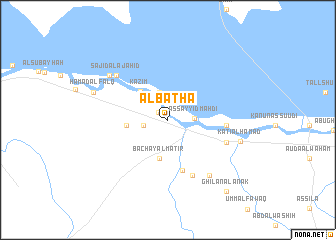
Al Baţḩāʼ (Dhī Qār, Iraq)Al Baţḩāʼ is a town in the Dhī Qār region of Iraq. An overview map of the region around Al Baţḩāʼ is displayed below.
regional and 3d topo map of Al Baţḩāʼ, Iraq ::
Al Baţḩāʼ airports ::
The nearest airport is BSR - Basrah Intl, located 182.4 km east of Al Baţḩāʼ.
Nearby towns ::
Āl ‘Awwād (1.2km north west) //
Al Bunūd (2.5km west) //
As Sayyid Mahdī (2.5km east) //
Ghālī Āl Baţūsh (3.2km north) //
Kāz̧im (4.1km north west) //
Bachāy Āl Maţīr (4.4km south) //
Jamā‘at al Kharīţah (4.0km west) //
‘Alī al Jūdah (5.8km south) //
Ḩusayn ash Shanober (5.6km east) //
‘Abd al Qādir (6.6km south) //
‘Alī al Jūdah (6.1km south east) //
Sājid al Ajāḩid (7.0km north west) //
Şabāḩ Āl Mashhad (7.3km south east) //
Khiḑr Dardash (7.4km north west) //
Kāţi‘ Āl Ḩamad (7.3km east) //
Ḩamad al Falq (7.8km north west) //
Ghīlān Āl ‘Anak (9.8km south east) //
[all distances 'as the bird flies' and approximate] 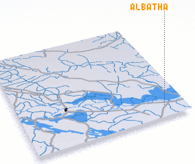 Places with similar names to Al Baţḩāʼ, Iraq ::
// Al Bathah (SA)
// Al Baḩḩāth (JO)
// Al Būthah (SY)
// Al Būthah (SY)
// Al Ba‘āʼith (SA)
// Al Baḩth (YE)
// Al Baţḩ (YE)
// Al Baţḩ (YE)
Disclaimer :: Information on this page comes without warranty of any kind |
||
|
Where is Al Baţḩāʼ? Elevation and coordinates ::
Latitude (lat): 31°7'20"N Longitude (lon): 45°52'30"E
Elevation (approx.): 9m (map arrows pan, magnifying glasses zoom) |
||
|
Visiting Al Baţḩāʼ? Hotel/Accommodation ::
Book a hotel in Al Baţḩāʼ Travel Guide ::
Buy a travel guide for Iraq rental cars ::
car rental offers GPS waypoint ::
download a GPX waypoint (PoI) of Al Baţḩāʼ for your GPS receiver
|
||