|
search place name
|
||
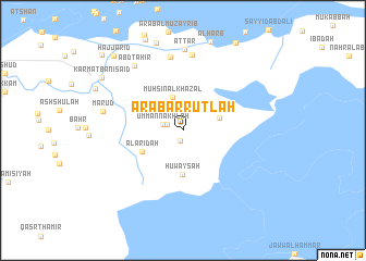
‘Arab ar Ruţlah (Dhī Qār, Iraq)‘Arab ar Ruţlah is a town in the Dhī Qār region of Iraq. An overview map of the region around ‘Arab ar Ruţlah is displayed below.
regional and 3d topo map of ‘Arab ar Ruţlah, Iraq ::
‘Arab ar Ruţlah airports ::
The nearest airport is BSR - Basrah Intl, located 102.1 km east of ‘Arab ar Ruţlah.
Other airports nearby include ABD - Abadan (160.0 km east), KWI - Kuwait Intl (218.8 km south east), Nearby towns ::
Umm ad Dayrī (1.1km south) //
Ḩājj Daḩḩām (1.5km north west) //
Umm an Nakhlah (1.8km west) //
Muḩsin al Khaz‘al (3.6km north) //
Ālbū Uzayrij (3.5km east) //
Ḩuwayşah (4.5km south) //
Al ‘Arīḑah (4.2km south west) //
Umm Shajāj (7.6km north) //
Ālbū Khalīfah (7.8km north) //
Aţ Ţār (8.3km north) //
‘Abd Ţāhir (7.9km north west) //
Ma‘rūḑ (7.3km west) //
Karmat Banī Sa‘īd (9.0km north west) //
Ḩājj ‘Arīd (9.8km north west) //
Wardawi Naji (10.6km north west) //
[all distances 'as the bird flies' and approximate] 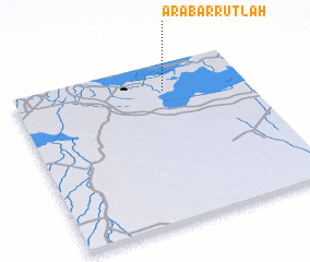 Places with similar names to ‘Arab ar Ruţlah, Iraq ::
// Arbordale (US)
Disclaimer :: Information on this page comes without warranty of any kind |
||
|
Where is ‘Arab ar Ruţlah? Elevation and coordinates ::
Latitude (lat): 30°49'52"N Longitude (lon): 46°38'50"E
Elevation (approx.): 3m (map arrows pan, magnifying glasses zoom) |
||
|
Visiting ‘Arab ar Ruţlah? Hotel/Accommodation ::
Book a hotel in ‘Arab ar Ruţlah Travel Guide ::
Buy a travel guide for Iraq rental cars ::
car rental offers GPS waypoint ::
download a GPX waypoint (PoI) of ‘Arab ar Ruţlah for your GPS receiver
|
||