|
search place name
|
||
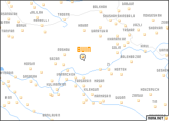
Būʼīn (As Sulaymānīyah, Iraq)Būʼīn is a town in the As Sulaymānīyah region of Iraq. An overview map of the region around Būʼīn is displayed below.
regional and 3d topo map of Būʼīn, Iraq ::
Būʼīn airports ::
The nearest airport is SDG - Sanandaj, located 82.8 km east of Būʼīn.
Other airports nearby include KSH - Bakhtaran Shahid Ashrafi Esfahani (126.8 km south east), Nearby towns ::
Zhāleh ‘Os̄mān Beyk (3.8km south) //
Mīshāv-e Soflá (3.5km south east) //
Zhāleh Qobād Beyk (4.1km south west) //
Zhāleh Raḩmān Beyk (4.1km south west) //
Lāneh Vān (3.8km south west) //
Rashāw (3.9km west) //
Kōsāwah (3.9km west) //
Targārān (5.7km south) //
Zī (4.8km south east) //
Varāmcheh (5.3km south west) //
Anjīrak Īnāghī (5.9km south) //
Sāzān (5.3km west) //
Daratuwa (6.2km north east) //
Hāwār (6.6km north) //
Māsān (6.4km south east) //
Chūk (5.7km south east) //
Golīn (6.2km east) //
Dagāsīāb (7.5km south) //
Kīlehgūn (7.6km south) //
Khanānkar (7.0km north east) //
Pālāniyah (7.9km north) //
Nayjālah (7.4km south west) //
Herteh (7.3km south east) //
Amreh Khal (8.8km south) //
Kūlī Mankān (8.1km south west) //
Shīneh (8.1km north east) //
Anjīrak-e Zardūnī (8.8km south west) //
Sheykhān (8.0km north east) //
Bāral (9.7km south west) //
[all distances 'as the bird flies' and approximate]  Places with similar names to Būʼīn, Iraq ::
Disclaimer :: Information on this page comes without warranty of any kind |
||
|
Where is Būʼīn? Elevation and coordinates ::
Latitude (lat): 35°6'3"N Longitude (lon): 46°7'5"E
Elevation (approx.): 1004m (map arrows pan, magnifying glasses zoom) |
||
|
Visiting Būʼīn? Hotel/Accommodation ::
Book a hotel in Būʼīn Travel Guide ::
Buy a travel guide for Iraq rental cars ::
car rental offers GPS waypoint ::
download a GPX waypoint (PoI) of Būʼīn for your GPS receiver
|
||