|
search place name
|
||
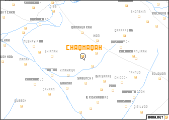
Chaqmāqah (At Taʼmīm, Iraq)Chaqmāqah is a town in the At Taʼmīm region of Iraq. An overview map of the region around Chaqmāqah is displayed below.
regional and 3d topo map of Chaqmāqah, Iraq ::
Nearby towns ::
Idrīs Tamr (2.0km south east) //
Tall ‘Azīz (2.6km north east) //
Kīnah Rivi (4.6km south west) //
Mar‘ī (4.9km north east) //
Şābūnchī (5.2km south) //
Qarah Darah (6.1km north) //
Idrīs ‘Arab (5.9km south east) //
Shīrnāw (5.9km west) //
Dawrām (7.1km south west) //
Idrīs Kākah ‘Abd Allāh (7.3km south east) //
Ţaqţaq (6.8km south west) //
Qūshqāyah (7.2km north east) //
Rāmī (8.6km south east) //
Chirāgh (8.5km south east) //
Qara Arbad (9.0km north east) //
Dawrām (10.0km south west) //
[all distances 'as the bird flies' and approximate]  Places with similar names to Chaqmāqah, Iraq ::
// Shakum Ga (MM)
// Chickamauga (US)
// Chakhmāq (IR)
// Chakhmāq (IR)
// Shekomeko (US)
// Chagamuka (ZM)
// Chagumuka (ZM)
// Chāka Māka (PK)
// Chacmuco (BO)
// Chúc Mac (VN)
Disclaimer :: Information on this page comes without warranty of any kind |
||
|
Where is Chaqmāqah? Elevation and coordinates ::
Latitude (lat): 35°34'35"N Longitude (lon): 44°8'0"E
Elevation (approx.): 287m (map arrows pan, magnifying glasses zoom) |
||
|
Visiting Chaqmāqah? Hotel/Accommodation ::
Book a hotel in Chaqmāqah Travel Guide ::
Buy a travel guide for Iraq rental cars ::
car rental offers GPS waypoint ::
download a GPX waypoint (PoI) of Chaqmāqah for your GPS receiver
|
||