|
search place name
|
||
Chiragha Ruta (As Sulaymānīyah, Iraq)Chiragha Ruta is a town in the As Sulaymānīyah region of Iraq. An overview map of the region around Chiragha Ruta is displayed below.
regional and 3d topo map of Chiragha Ruta, Iraq ::

Chiragha Ruta airports ::
The nearest airport is SDG - Sanandaj, located 181.2 km east of Chiragha Ruta.
Nearby towns ::
Kunakōtir (1.7km north) //
Khel-i Azīz-i Aḩmad-i Dashtī (2.4km south west) //
Dōtān (4.7km south east) //
Zanan (5.0km north) //
Qūla (4.4km north east) //
Qal‘ah Chōgah (4.6km north west) //
Malā ʼusayn (5.1km south east) //
Khewlanāka (6.2km south) //
Aḩmad Lawand (6.9km north) //
Kani Qara (6.9km north) //
Mamlaha (7.0km south) //
Hākiz (7.0km north west) //
Qerkh (9.2km south west) //
Şūfī Ḩasan (9.3km north east) //
Kānī Muşţafá (10.7km north east) //
[all distances 'as the bird flies' and approximate] 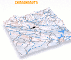 Places with similar names to Chiragha Ruta, Iraq ::
// Sherrard (US)
// Chorrerita (PA)
// Chorrerita (PA)
// Charartu (IQ)
// Sherard (US)
// Cherarda (MA)
// Sherrard (US)
Disclaimer :: Information on this page comes without warranty of any kind |
||
|
Where is Chiragha Ruta? Elevation and coordinates ::
Latitude (lat): 35°25'3"N Longitude (lon): 45°1'39"E
Elevation (approx.): 565m (map arrows pan, magnifying glasses zoom) |
||
|
Visiting Chiragha Ruta? Hotel/Accommodation ::
Book a hotel in Chiragha Ruta Travel Guide ::
Buy a travel guide for Iraq rental cars ::
car rental offers GPS waypoint ::
download a GPX waypoint (PoI) of Chiragha Ruta for your GPS receiver
|
||