|
search place name
|
||
Fagē Hājī (As Sulaymānīyah, Iraq)Fagē Hājī is a town in the As Sulaymānīyah region of Iraq. An overview map of the region around Fagē Hājī is displayed below.
regional and 3d topo map of Fagē Hājī, Iraq ::

Fagē Hājī airports ::
The nearest airport is SDG - Sanandaj, located 171.9 km east of Fagē Hājī.
Nearby towns ::
Hashazīnī (2.2km north) //
Tappah Sūrah (2.8km north) //
Darwēshān-i Gawra (3.9km east) //
Khalīl-i Ḩājī (4.9km north east) //
Malā ʼusayn (4.5km west) //
Gōmazard (4.7km east) //
Kalarash (5.3km south east) //
Kalla Kazhi (5.5km south east) //
Dōtān (7.0km west) //
Qūla (7.7km north west) //
Dilka (7.5km south east) //
Zālāw (10.0km south west) //
Dēlēzha (10.1km north east) //
Hamza Rūhi (11.5km south east) //
[all distances 'as the bird flies' and approximate] 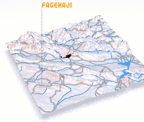 Places with similar names to Fagē Hājī, Iraq :: Disclaimer :: Information on this page comes without warranty of any kind |
||
|
Where is Fagē Hājī? Elevation and coordinates ::
Latitude (lat): 35°23'15"N Longitude (lon): 45°7'35"E
Elevation (approx.): 627m (map arrows pan, magnifying glasses zoom) |
||
|
Visiting Fagē Hājī? Hotel/Accommodation ::
Book a hotel in Fagē Hājī Travel Guide ::
Buy a travel guide for Iraq rental cars ::
car rental offers GPS waypoint ::
download a GPX waypoint (PoI) of Fagē Hājī for your GPS receiver
|
||