|
search place name
|
||
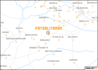
Fayşal Iyāmān (Diyālá, Iraq)Fayşal Iyāmān is a town in the Diyālá region of Iraq. An overview map of the region around Fayşal Iyāmān is displayed below.
regional and 3d topo map of Fayşal Iyāmān, Iraq ::
Fayşal Iyāmān airports ::
The nearest airport is KSH - Bakhtaran Shahid Ashrafi Esfahani, located 174.3 km east of Fayşal Iyāmān.
Other airports nearby include SDG - Sanandaj (193.0 km north east), Nearby towns ::
Nāwdūmān (3.2km south) //
‘Ayn al Hilāl (3.6km south east) //
Kukha Muşţafá (4.8km north east) //
Ibrāhīm Nasīb (5.3km south west) //
Maḩmūd Bayk (5.8km north) //
As‘ad Bayk (5.8km north) //
Akhjīr (5.0km west) //
Ţāhir Afandī (6.1km north east) //
‘Alī Aḩmad Bayk (6.3km north east) //
Ḩabīb (5.9km north east) //
Wādī al ‘Awsaj (5.6km west) //
‘Arab Sayyid Ḩusayn (6.8km south west) //
Shatīk Āghā (7.6km north) //
Qaryat ‘Alī Şaghīr (7.6km south) //
Imām Sulţān (7.2km north east) //
Mahdī Bayk (7.8km north east) //
Kukha Muḩammad (7.4km north east) //
Ḩasan Bayk (8.0km north) //
‘Alī Jān (8.9km north) //
Sa‘d Allāh Afandī (8.3km north east) //
[all distances 'as the bird flies' and approximate] 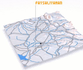 Places with similar names to Fayşal Iyāmān, Iraq :: Disclaimer :: Information on this page comes without warranty of any kind |
||
|
Where is Fayşal Iyāmān? Elevation and coordinates ::
Latitude (lat): 34°16'0"N Longitude (lon): 45°16'0"E
Elevation (approx.): 249m (map arrows pan, magnifying glasses zoom) |
||
|
Visiting Fayşal Iyāmān? Hotel/Accommodation ::
Book a hotel in Fayşal Iyāmān Travel Guide ::
Buy a travel guide for Iraq rental cars ::
car rental offers GPS waypoint ::
download a GPX waypoint (PoI) of Fayşal Iyāmān for your GPS receiver
|
||