|
search place name
|
||
Girda Sher (Arbīl, Iraq)Girda Sher is a town in the Arbīl region of Iraq. An overview map of the region around Girda Sher is displayed below.
regional and 3d topo map of Girda Sher, Iraq ::
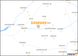
Nearby towns ::
Kharābah Darāw (2.6km north east) //
Gaynī (4.3km north west) //
Sīdān (4.9km north east) //
Qalātka (5.5km south east) //
Qalān Jūghān (4.8km east) //
Daraband (5.5km east) //
Jadīdah (5.7km west) //
Mamolak (7.1km north west) //
Topzāwa (6.8km west) //
Sabīrān (7.6km south east) //
Shiwarash (8.9km north west) //
Banī Nān (10.3km north west) //
Koraban (10.3km south west) //
[all distances 'as the bird flies' and approximate] 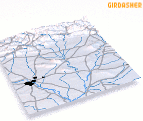 Places with similar names to Girda Sher, Iraq ::
// Gird Sher (IQ)
Disclaimer :: Information on this page comes without warranty of any kind |
||
|
Where is Girda Sher? Elevation and coordinates ::
Latitude (lat): 36°17'44"N Longitude (lon): 43°50'32"E
Elevation (approx.): 318m (map arrows pan, magnifying glasses zoom) |
||
|
Visiting Girda Sher? Hotel/Accommodation ::
Book a hotel in Girda Sher Travel Guide ::
Buy a travel guide for Iraq rental cars ::
car rental offers GPS waypoint ::
download a GPX waypoint (PoI) of Girda Sher for your GPS receiver
|
||