|
search place name
|
||
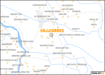
Ḩājjī ‘Abbās (Bābil, Iraq)Ḩājjī ‘Abbās is a town in the Bābil region of Iraq. An overview map of the region around Ḩājjī ‘Abbās is displayed below.
regional and 3d topo map of Ḩājjī ‘Abbās, Iraq ::
Nearby towns ::
Qaryat al Karjīyah (1.1km west) //
Qaryat al Jifjāfah (1.7km south) //
Sayyid Mahawish (1.6km west) //
Mullā ‘Abbūd (2.4km north west) //
Khuḑayr al Muḩammad (3.1km west) //
Qaryat ‘Abīd al Barrāj (3.3km west) //
Ash Shaykh ‘Alī (4.0km south west) //
Tawfīq Fikrat (4.0km north east) //
Al Ḩaşwah (5.0km north) //
Al ‘Aşrīyah (5.6km north) //
Nāşir Laftah (5.5km south east) //
Qaryat Muwayliḩah ath Thānīyah (6.2km north east) //
Qaryat Muwayliḩah al Ūlá (5.8km east) //
Qaryat Abū Jāsim (7.1km south) //
Qaryat Sa‘ūd Tāyah (7.2km south east) //
Al Iskandarīyah (7.3km north west) //
Ghālī al Mughayyar (7.2km south west) //
Qal‘at Fayşal al Qadīmah (8.0km south east) //
Khalāʼif (8.0km north east) //
Ḩammūd al ‘Abbās (8.5km north) //
Ḩusayn (7.4km east) //
Salmān (8.8km north east) //
Qaryat Manşūrī (9.3km south east) //
Ar Raḩīm (11.1km north east) //
[all distances 'as the bird flies' and approximate]  Places with similar names to Ḩājjī ‘Abbās, Iraq ::
// Hāji Abbās (PK)
// Ḩājjī ‘Abbāsī (IR)
// Hejiabaozi (CN)
// Hejiabaozi (CN)
// Hujiabaozi (CN)
// Hujiabaozi (CN)
Disclaimer :: Information on this page comes without warranty of any kind |
||
|
Where is Ḩājjī ‘Abbās? Elevation and coordinates ::
Latitude (lat): 32°50'0"N Longitude (lon): 44°23'0"E
Elevation (approx.): 33m (map arrows pan, magnifying glasses zoom) |
||
|
Visiting Ḩājjī ‘Abbās? Hotel/Accommodation ::
Book a hotel in Ḩājjī ‘Abbās Travel Guide ::
Buy a travel guide for Iraq rental cars ::
car rental offers GPS waypoint ::
download a GPX waypoint (PoI) of Ḩājjī ‘Abbās for your GPS receiver
|
||