|
search place name
|
||
Ḩamad ‘Arab (Diyālá, Iraq)Ḩamad ‘Arab is a town in the Diyālá region of Iraq. An overview map of the region around Ḩamad ‘Arab is displayed below.
regional and 3d topo map of Ḩamad ‘Arab, Iraq ::
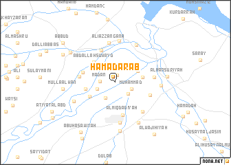
Nearby towns ::
‘Arab Ḩammādah (1.2km north) //
Ma‘dan (2.1km west) //
Shafqarāq (2.5km south east) //
Muḩammad (2.4km south east) //
Ḩasan al Jāsim (2.4km south east) //
Khaylānīyah (2.8km south west) //
Naqīb (2.7km south west) //
Al ‘Ālī (3.6km north east) //
Ismā‘īl al ‘Iss (3.8km east) //
Sinsil (4.1km south west) //
‘Abd Allāh Suwayd (4.4km north west) //
Jāsim (4.1km west) //
Al Miqdādīyah (5.3km south) //
Najm al ‘Abd Allāh (4.7km west) //
Dawālīb (5.5km north) //
Dakhīl al Muḩammad (4.9km west) //
Aḩmad Ḩammādī (5.1km south east) //
Khayjarān (5.3km east) //
Chārī (6.5km north) //
‘Alī az Zangana (6.5km north) //
Ghuziljah (6.0km south east) //
Shawk ar Rīm (6.0km south east) //
Jāsim Khalīl (6.6km south) //
Makkārīyīn (6.8km north) //
Manşūrīyat al Jabal (6.7km north east) //
Qaryat Barwānah al Kabīr (6.4km south west) //
Al Manşūrīyah (6.2km east) //
Al Bīnakānī aş Şadr (7.2km south east) //
Sikkah (7.9km south) //
[all distances 'as the bird flies' and approximate] 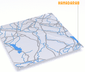 Places with similar names to Ḩamad ‘Arab, Iraq :: Disclaimer :: Information on this page comes without warranty of any kind |
||
|
Where is Ḩamad ‘Arab? Elevation and coordinates ::
Latitude (lat): 34°1'33"N Longitude (lon): 44°55'36"E
Elevation (approx.): 63m (map arrows pan, magnifying glasses zoom) |
||
|
Visiting Ḩamad ‘Arab? Hotel/Accommodation ::
Book a hotel in Ḩamad ‘Arab Travel Guide ::
Buy a travel guide for Iraq rental cars ::
car rental offers GPS waypoint ::
download a GPX waypoint (PoI) of Ḩamad ‘Arab for your GPS receiver
|
||