|
search place name
|
||
Ḩamdūn (At Taʼmīm, Iraq)Ḩamdūn is a town in the At Taʼmīm region of Iraq. An overview map of the region around Ḩamdūn is displayed below.
regional and 3d topo map of Ḩamdūn, Iraq ::
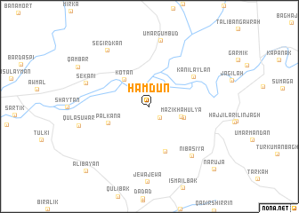
Nearby towns ::
Marzikha-i Khwārū (1.7km south east) //
Mazikhah ‘Ulyā (3.5km east) //
Mazikhah ‘Ulyā (3.8km east) //
Kōtān (4.3km north west) //
Palkāna (4.7km south west) //
Ḩasan Qibāq (5.8km south) //
Kānī Laylān (5.8km north east) //
Nibāsiyā (7.6km south east) //
‘Umar Gumbud (8.4km north) //
Sēkānī (7.1km north west) //
Sēgirdkān (8.3km north west) //
Qūlasuwār (7.6km west) //
Naruja (10.3km south east) //
‘Alī Bayān (10.4km south west) //
[all distances 'as the bird flies' and approximate] 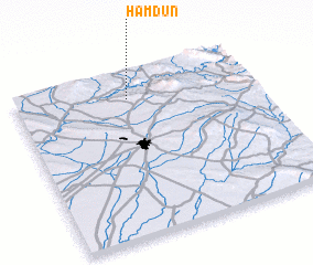 Places with similar names to Ḩamdūn, Iraq ::
Disclaimer :: Information on this page comes without warranty of any kind |
||
|
Where is Ḩamdūn? Elevation and coordinates ::
Latitude (lat): 35°50'22"N Longitude (lon): 44°28'26"E
Elevation (approx.): 388m (map arrows pan, magnifying glasses zoom) |
||
|
Visiting Ḩamdūn? Hotel/Accommodation ::
Book a hotel in Ḩamdūn Travel Guide ::
Buy a travel guide for Iraq rental cars ::
car rental offers GPS waypoint ::
download a GPX waypoint (PoI) of Ḩamdūn for your GPS receiver
|
||