|
search place name
|
||
Ḩayy ar Risālah (Al Başrah, Iraq)Ḩayy ar Risālah is a town in the Al Başrah region of Iraq. An overview map of the region around Ḩayy ar Risālah is displayed below.
regional and 3d topo map of Ḩayy ar Risālah, Iraq ::

Ḩayy ar Risālah airports ::
The nearest airport is BSR - Basrah Intl, located 10.3 km south west of Ḩayy ar Risālah.
Other airports nearby include ABD - Abadan (52.3 km south east), AWZ - Ahwaz (126.4 km north east), MRX - Bandar Mahshahr Mahshahr (134.4 km east), KWI - Kuwait Intl (153.7 km south), Nearby towns ::
Minţaqah al Ţīf (0.9km south) //
Al Mājidīyah (1.3km north) //
Al Karmah (1.3km south east) //
Shu‘aybat Kharāb (1.4km east) //
Al Badrān (1.9km south east) //
Ţarrādīyah (1.7km east) //
Al ‘Alī (2.7km south) //
Jāsim al Burghūth (2.8km north west) //
Qaryat ‘Abd ar Raḩman (2.8km south west) //
Al Jazīrah ath Thāniyah (2.9km north east) //
Al Lishmān (3.4km north) //
Al Jazīrah ar Rābi‘ah (3.4km north east) //
Muḩammad Jawād (3.9km north) //
Al ‘Anbarī (4.1km north) //
Qarmat ‘Alī (4.0km south) //
Al Hārthah (3.7km south east) //
Qaryat Kūllīyat (4.5km north) //
Al Karmah (4.3km south west) //
Al Jawīyah (4.1km east) //
Al Kazīzah (5.0km south) //
Shu‘aybah (4.8km south east) //
Ḩājj Şāliḩ (5.1km south west) //
Al Mu‘aydī (5.5km north) //
Fīrūzīyah (5.1km south east) //
Jazīrat al Harj (4.9km west) //
Ţirād Khurr (5.6km south) //
Qaryat Ḩarīr (5.2km west) //
Ḩayy al Intişār (6.3km north) //
Al Ḩayy al Markazī (6.4km south) //
[all distances 'as the bird flies' and approximate] 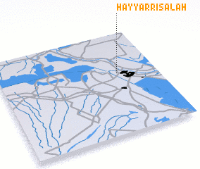 Places with similar names to Ḩayy ar Risālah, Iraq ::
Disclaimer :: Information on this page comes without warranty of any kind |
||
|
Where is Ḩayy ar Risālah? Elevation and coordinates ::
Latitude (lat): 30°36'2"N Longitude (lon): 47°45'7"E
Elevation (approx.): 3m (map arrows pan, magnifying glasses zoom) |
||
|
Visiting Ḩayy ar Risālah? Hotel/Accommodation ::
Book a hotel in Ḩayy ar Risālah Travel Guide ::
Buy a travel guide for Iraq rental cars ::
car rental offers GPS waypoint ::
download a GPX waypoint (PoI) of Ḩayy ar Risālah for your GPS receiver
|
||