|
search place name
|
||
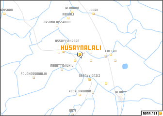
Ḩusayn al ‘Alī (Wāsiţ, Iraq)Ḩusayn al ‘Alī is a town in the Wāsiţ region of Iraq. An overview map of the region around Ḩusayn al ‘Alī is displayed below.
regional and 3d topo map of Ḩusayn al ‘Alī, Iraq ::
Ḩusayn al ‘Alī airports ::
The nearest airport is BSR - Basrah Intl, located 248.8 km south east of Ḩusayn al ‘Alī.
Nearby towns ::
Zinābīyah (1.2km north) //
Zuwayyah (1.4km south west) //
Qal‘at Muḩammad as Sulaymān (2.0km east) //
Shaykh ‘Āmir (2.2km north east) //
Al Muwaffaqīyah (3.8km north west) //
As Sayyid Ḩasan (4.2km north west) //
As Sayyid Muhīj (4.7km south west) //
As Sayyid ‘Azīz (5.2km south) //
Muḩayrījah (4.6km west) //
Suwaylim (4.7km east) //
Laftāh (5.7km east) //
Al Jādhūb (6.6km east) //
‘Arab Ḩasan ad Duwāzah (7.5km south east) //
Ḩāmid Beg (8.3km south) //
‘Abd al Hādī Bak (8.5km south) //
Jāsim ‘Alī as Sa‘dūn (8.8km north west) //
[all distances 'as the bird flies' and approximate] 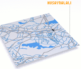 Places with similar names to Ḩusayn al ‘Alī, Iraq ::
// Ḩasan al ‘Alī (SY)
// Ḩasan al ‘Alī (IQ)
// Ḩusayn al ‘Alī (IQ)
// Ḩusayn al ‘Alī (IQ)
// Ḩusayn al ‘Alī (IQ)
// Ḩişn al ‘Alī (YE)
Disclaimer :: Information on this page comes without warranty of any kind |
||
|
Where is Ḩusayn al ‘Alī? Elevation and coordinates ::
Latitude (lat): 32°15'21"N Longitude (lon): 45°57'48"E
Elevation (approx.): 20m (map arrows pan, magnifying glasses zoom) |
||
|
Visiting Ḩusayn al ‘Alī? Hotel/Accommodation ::
Book a hotel in Ḩusayn al ‘Alī Travel Guide ::
Buy a travel guide for Iraq rental cars ::
car rental offers GPS waypoint ::
download a GPX waypoint (PoI) of Ḩusayn al ‘Alī for your GPS receiver
|
||