|
search place name
|
||
Ibn Ātī (Wāsiţ, Iraq)Ibn Ātī is a town in the Wāsiţ region of Iraq. An overview map of the region around Ibn Ātī is displayed below.
regional and 3d topo map of Ibn Ātī, Iraq ::

Ibn Ātī airports ::
The nearest airport is KSH - Bakhtaran Shahid Ashrafi Esfahani, located 246.0 km north east of Ibn Ātī.
Other airports nearby include BSR - Basrah Intl (261.8 km south east), Nearby towns ::
Bayt al Kabāb (2.0km north) //
‘Alīm Nāhī (3.7km south east) //
‘Ābid ‘Alī (4.9km south) //
Larak (5.6km north) //
‘Abd Allāh al Ghashīm (6.1km north west) //
Jāsim ‘Alī as Sa‘dūn (6.9km south) //
Jūdah (6.8km south east) //
Qaryat ‘Uţāsh (7.5km north west) //
[all distances 'as the bird flies' and approximate] 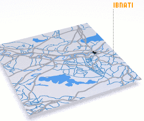 Places with similar names to Ibn Ātī, Iraq ::
Disclaimer :: Information on this page comes without warranty of any kind |
||
|
Where is Ibn Ātī? Elevation and coordinates ::
Latitude (lat): 32°22'59"N Longitude (lon): 45°55'40"E
Elevation (approx.): 20m (map arrows pan, magnifying glasses zoom) |
||
|
Visiting Ibn Ātī? Hotel/Accommodation ::
Book a hotel in Ibn Ātī Travel Guide ::
Buy a travel guide for Iraq rental cars ::
car rental offers GPS waypoint ::
download a GPX waypoint (PoI) of Ibn Ātī for your GPS receiver
|
||